
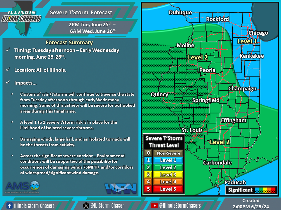
(2:00PM – Tuesday, June 25th, 2024) Tuesday afternoon update on a storm system will continue to move through the region through Wednesday, bringing additional clusters of rain and t’storms to the state from this afternoon through early Wednesday morning. Severe t’storms will be likely with some of this activity across outlooked areas during portions of this timeframe.
Update…
•With this update on the severe t’storm forecast for much of today/tonight, just most noteworthy change was to adjust coverage of the level 2 severe t’storm threat corridor. This changes was made based on real-time observations, trends, and weather model guidance.
Timing & Location…
•This Afternoon – Early Wednesday Morning, June 25-26th: All of Illinois.
Impacts…
•A level 1 to 2 severe t’storm risk is in place across all of Illinois from this afternoon through early Wednesday morning for the likelihood of isolated to widely scattered severe t’storms. Damaging winds, large hail, and an isolated tornado will be the threats from activity. Across the significant severe corridor… Environmental conditions will be supportive of the possibility of occurrences of damaging winds 75MPH+ and/or corridors of widespread/significant wind damage.
Discussion…
•Clusters of showers and t’storms will continue to traverse a large portion of the state from this afternoon through early Wednesday morning. An environment will be in place that will be supportive of severe t’storms; thus, some of the activity during this timeframe will be severe across the outlooked areas. Forecast soundings suggest damaging winds, large hail, and an isolated tornado will be the threats with activity.
