(10:45AM – Tuesday, July 2nd, 2024) A storm system will move through the region from today through Thursday, bringing a few rounds of rain and t’storms to the state from this morning through early Thursday morning. Severe t’storms will be possible with some of this activity across outlooked areas during portions of this timeframe.
Timing & Location…
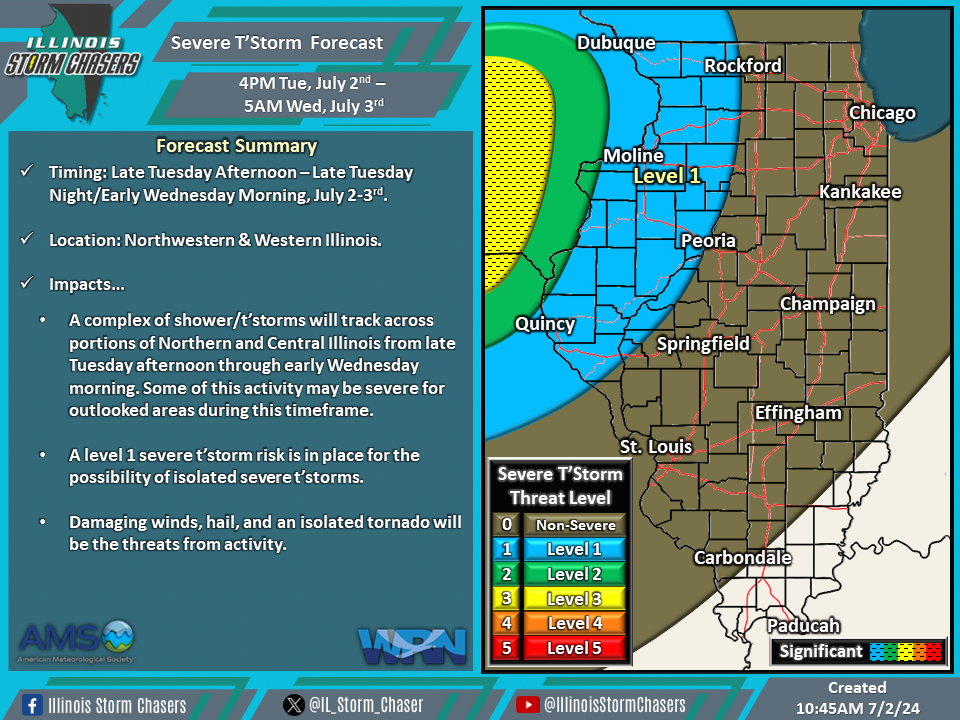
•Late This Afternoon – Early Wednesday Morning, July 2-3rd: Northwestern & Western Illinois.
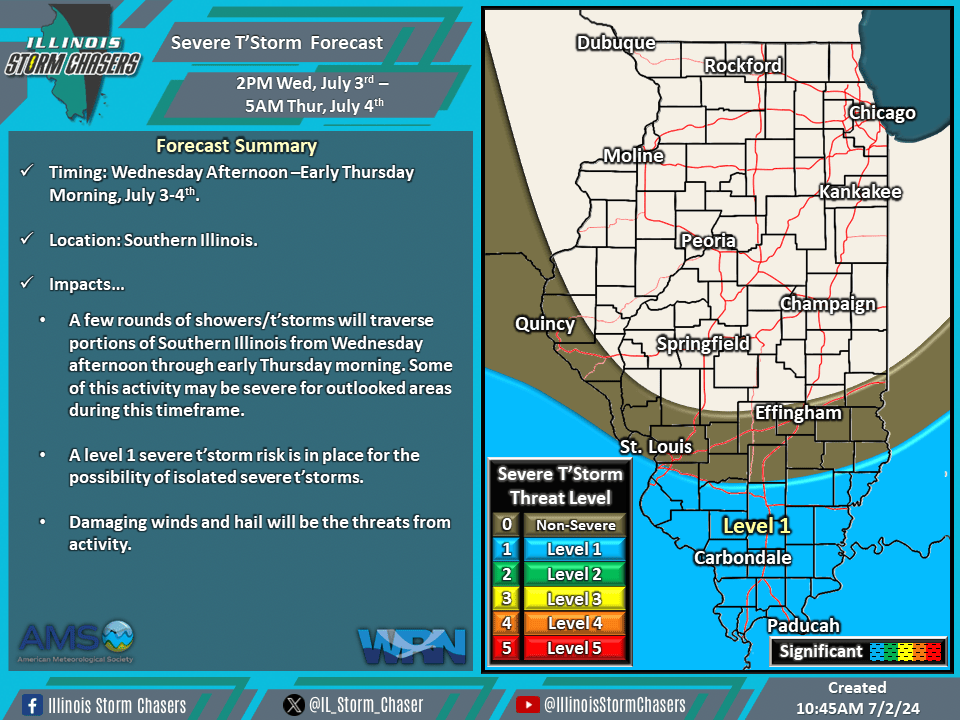
•Wednesday Afternoon – Early Thursday Morning, July 3-4th: Southern Illinois.
Impacts…
•A level 1 severe t’storm risk is in place across Northwestern and Western Illinois from late this afternoon through early Wednesday morning for the possibility of isolated severe t’storms. Damaging winds, hail, and an isolated tornado will be the threats from activity.
•A level 1 severe t’storm risk is in place across Southern Illinois from Wednesday afternoon through early Thursday morning for the possibility of isolated to severe t’storms. Damaging winds and hail will be the threats from activity.
Discussion…
•As a storm system moves through the region from today through Thursday, multiple rounds of rain/t’storms can be expected across the state from this morning through early Thursday morning.
•For this afternoon through early Wednesday morning, there will be a very sharp cutoff in environmental conditions supportive of severe t’storms across Northwestern and Western Illinois. Thus, while there is a level 1/isolated severe t’storm threat across Northwestern and Western Illinois, the threat should quickly fade as activity moves from Iowa/Northern Missouri on into Illinois.
•For Wednesday afternoon into early Thursday morning, a few clusters of showers/t’storms will develop and traverse Southern Illinois and surrounding areas. Environmental conditions will be marginally supportive of severe t’storm activity; thus, a level 1/isolated severe t’storm threat is in place.