
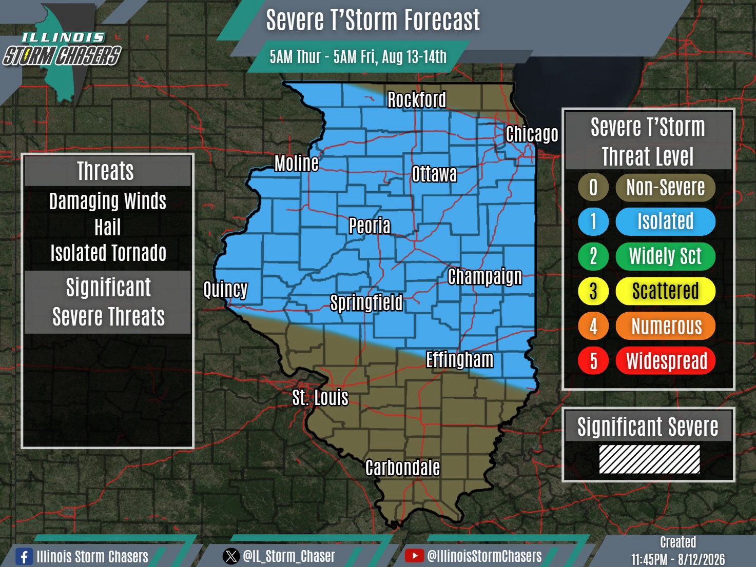
(11:45PM – Wednesday, August 12th, 2026)
Severe Weather Threat Thursday/Thursday Night ⚡
A complex of t’storms/severe t’storms (MCS) that is ongoing across South Dakota and Nebraska tonight (Wednesday night) will track eastward across Iowa overnight and into early Wednesday morning. This complex, in a weakening phase, will then slide east-southeast portions of Northern and Central Illinois between mid morning and early afternoon on Wednesday. While this complex is expected to be in a weakening phase, some severe weather threat will exist at isolated coverage levels. The best chance for this will generally be along/south of I-80 and along/north of I-72.
In the wake of this complex, additional scattered showers and t’storms will be possible across Northern and Central Illinois, especially from Thursday evening into Thursday night. Once again, there may be an isolated coverage severe weather threat with this activity as well. Additionally, there is some support within weather guidance that there may be some training activity, which could lead to a flooding threat.
#ilwx #severeweather
