
(11:45PM – Sunday, April 26th, 2026) Severe weather threat returns for Monday/Monday night…
⚠️Update…
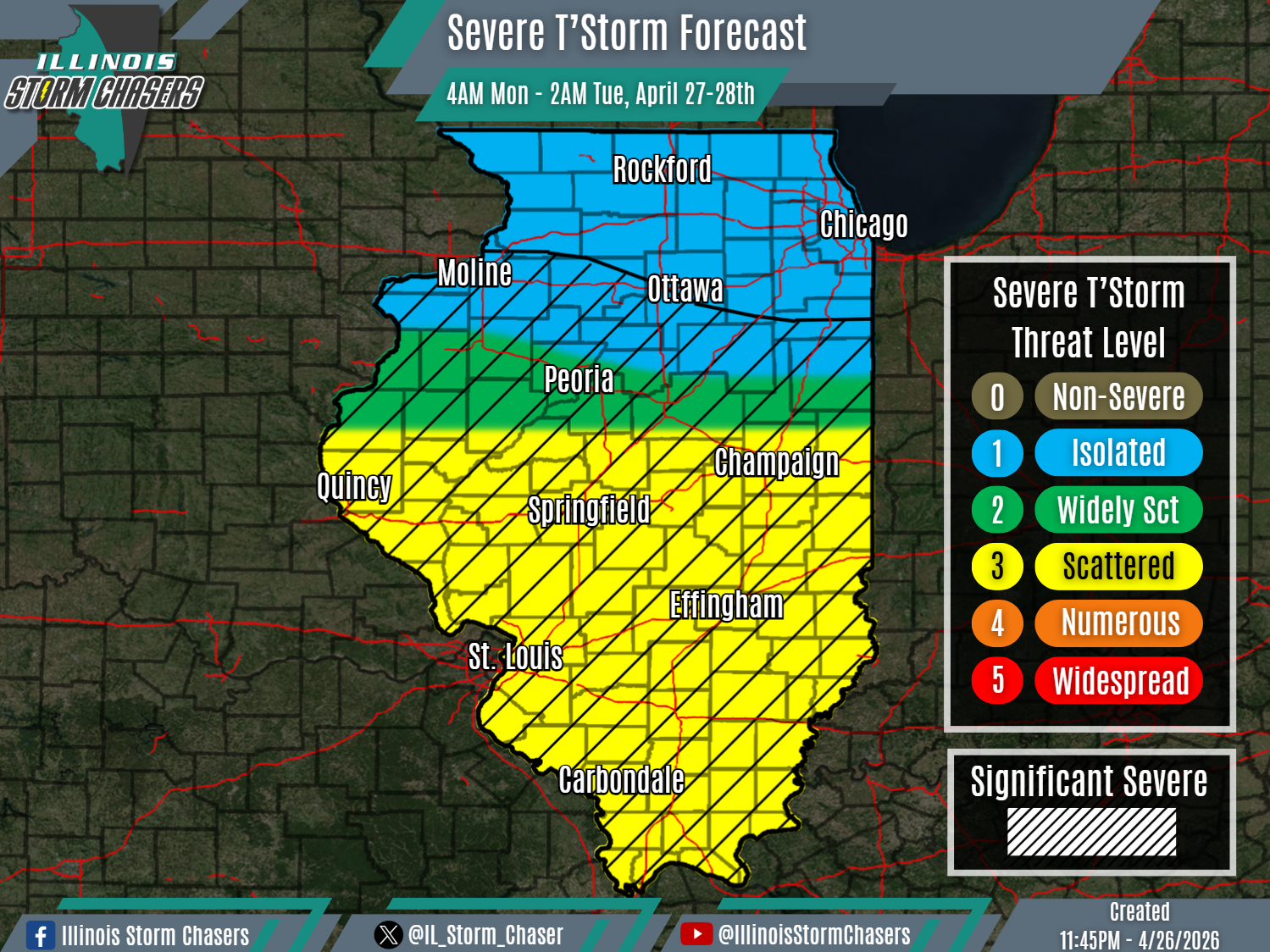
•With this update cycle, on the forecast for Monday/Monday night, we have slightly adjusted severe t’storm probabilities along the gradient across portions of Central Illinois. This changes was made based on the latest trends within weather guidance. Otherwise, little to no other changes were needed to the going forecast.
⏰📍Timing & Location…
•Monday Morning – Early Tuesday Morning, April 27-28th: All of Illinois.
⚡️Hazards…
•A level 1 to 3 severe t’storm threat is in place across the state from Monday morning through early Tuesday morning, for the threat of isolated to scattered severe t’storms. All modes of severe weather will be likely, including large hail, damaging winds and a few/several tornadoes. Some significant severe t’storms will be possible as well across a large portion of the state as well, capable of producing very large hail (2.00″+), significant damaging winds (75MPH+), swaths/corridors of damaging winds and/or strong tornadoes.
✔️Summary…
•Monday Morning – Early Tuesday Morning… A complex or two of rain and t’storms (MCS’s) will track across the state from tonight-Monday morning-Monday afternoon. Some of this activity, particularly during the Monday morning/afternoon timeframe, will carry a severe t’storm threat across portions of Central and Southern Illinois. In the wake of this activity, some rapid atmospheric recovery is expected to occur, setting the stage for another round of shower and t’storms to develop on Monday afternoon across Eastern Missouri and Western/Southwestern Illinois, along and ahead of an advancing cold front. This activity will then sweep eastward across Central and Southern Illinois, posing a severe t’storm threat from Monday afternoon into Monday night. Additionally, some of this activity may develop further north as well, across Eastern Iowa and Northwestern Illinois, then moving across Northern Illinois. However, the severe t’storm threat further north is expected to be lower overall (coverage and severity), due to less expected recovery in the wake of earlier day activity.
