
(11:45AM – Sunday, April 26th, 2026) A severe t’storm threat will return to the state early this week…
⏰📍Timing & Location…
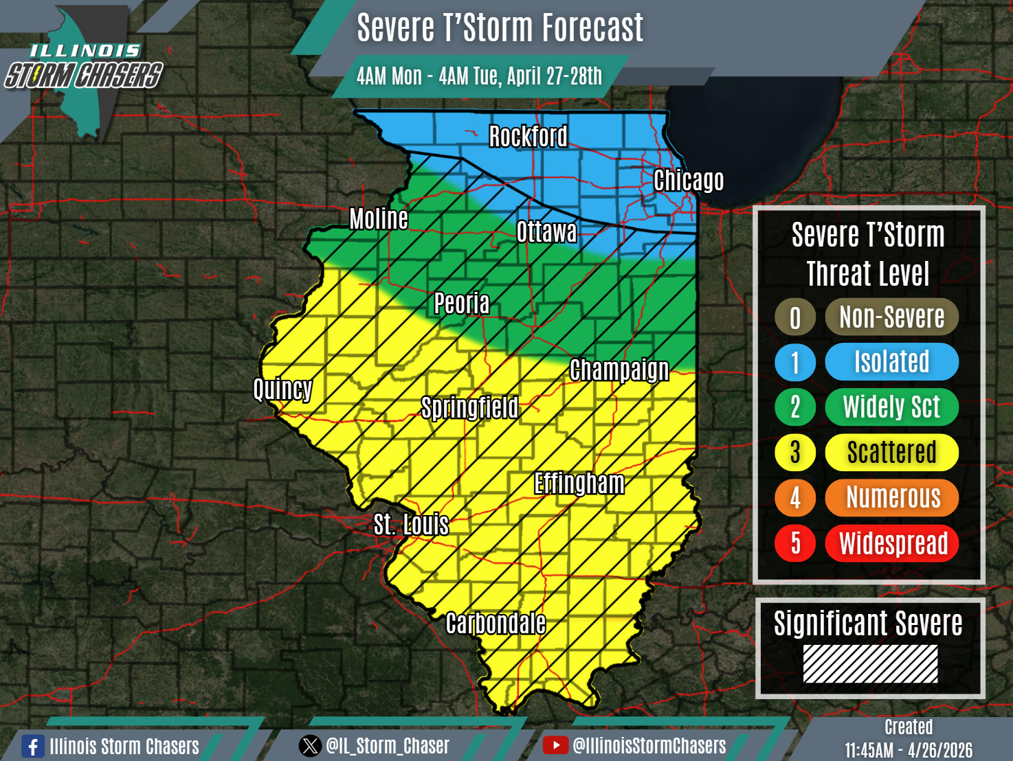
•Monday Morning – Early Tuesday Morning, April 27-28th: All of Illinois.
⚡️Hazards…
•A level 1 to 3 severe t’storm threat is in place across the state from Monday morning through early Tuesday morning, for the threat of isolated to scattered severe t’storms. All modes of severe weather will be possible, including large hail, damaging winds and a few/several tornadoes. Some significant severe t’storms will be possible as well across a large portion of the state as well, capable of producing very large hail (2.00″+), significant damaging winds (75MPH+), swaths/corridors of damaging winds and/or strong tornadoes.
✔️Summary…
•Monday Morning – Early Tuesday Morning… Some shower and t’storm activity will enter Western and Southwestern Illinois overnight tonight and early Monday morning. More widespread rain and t’storm activity, potentially in the form of a large complex (MCS) will then track across the state from Monday morning into Monday afternoon. A severe t’storm threat will be possible with some of this activity, across the southern half of the state. As the afternoon continues on, some recovery will be possible in the wake of the earlier day activity, which may be sufficient enough for another round of scattered showers and t’storms to develop along and ahead of an advancing cold front. A severe t’storm threat will be possible with this activity as well, as it then sweeps across the state through Monday night.
