
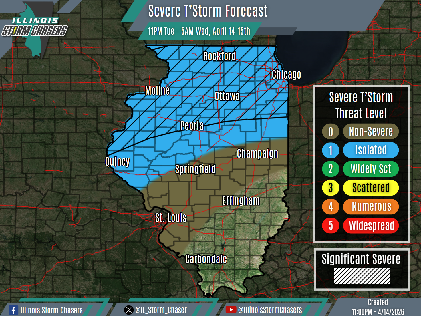
(11:00PM – Tuesday, April 14th, 2026) Severe weather threat continues thru Wednesday night/Thursday morning… #ILWx
⚠️Update…
•With this update cycle, on the forecast for tonight, adjustments have been made to severe t’storm probabilities based on trends and real-time observations.
•With this update cycle, no changes were needed to the going forecast for Wednesday/Wednesday night.
⏰📍Timing & Location…
•Tonight – Early Wednesday Morning, April 14-15th: Northern & Central Illinois.
•Wednesday Morning – Early Thursday Morning, April 15-16th: Much of Illinois.
⚡️Hazards…
•A level 1 severe t’storm threat is in place across Northern and portions of Central Illinois from tonight through early Wednesday morning, for the threat of isolated severe t’storms. Large hail and damaging winds will be the main threats, though an isolated tornado cannot be ruled out. Some significant severe t’storms will be possible across Northern and portions of Central Illinois as well, capable of producing very large hail (2.00″+) and/or significant damaging winds (75MPH+).
•A level 1 severe t’storm threat is in place across much of Illinois from Wednesday morning through early Thursday morning, for the threat of isolated severe t’storms. All modes of severe weather will be possible, including large hail, damaging winds and a couple of tornadoes.
✔️Summary…
•Tonight – Early Wednesday Morning… A complex (MCS) of rain, t’storm and severe t’storm activity is traversing portions of Northern Illinois early tonight. This activity may continue to back-build some across Northern Illinois overnight. Additionally, rain and t’storm activity developing early tonight across portions of Iowa, Missouri, Nebraska and Kansas will push across portions of Northern and Central Illinois later tonight and into Wednesday morning.
•Wednesday Morning – Early Thursday Morning… Multiple rounds of rain and t’storm activity will be likely across the state from Wednesday morning through Wednesday night/early Thursday morning. Because of this , a messy evoluation overall is expected throug hthe day and night on Wednesday. This will likely hinder a greater and/or more organized severe weather threat, leaving the overall threat more isolated in coverage.

