
(12:45PM – Wednesday, April 15th, 2026) Continued severe t’storm threat thru late tonight/early Thursday morning…
⚠️Update…
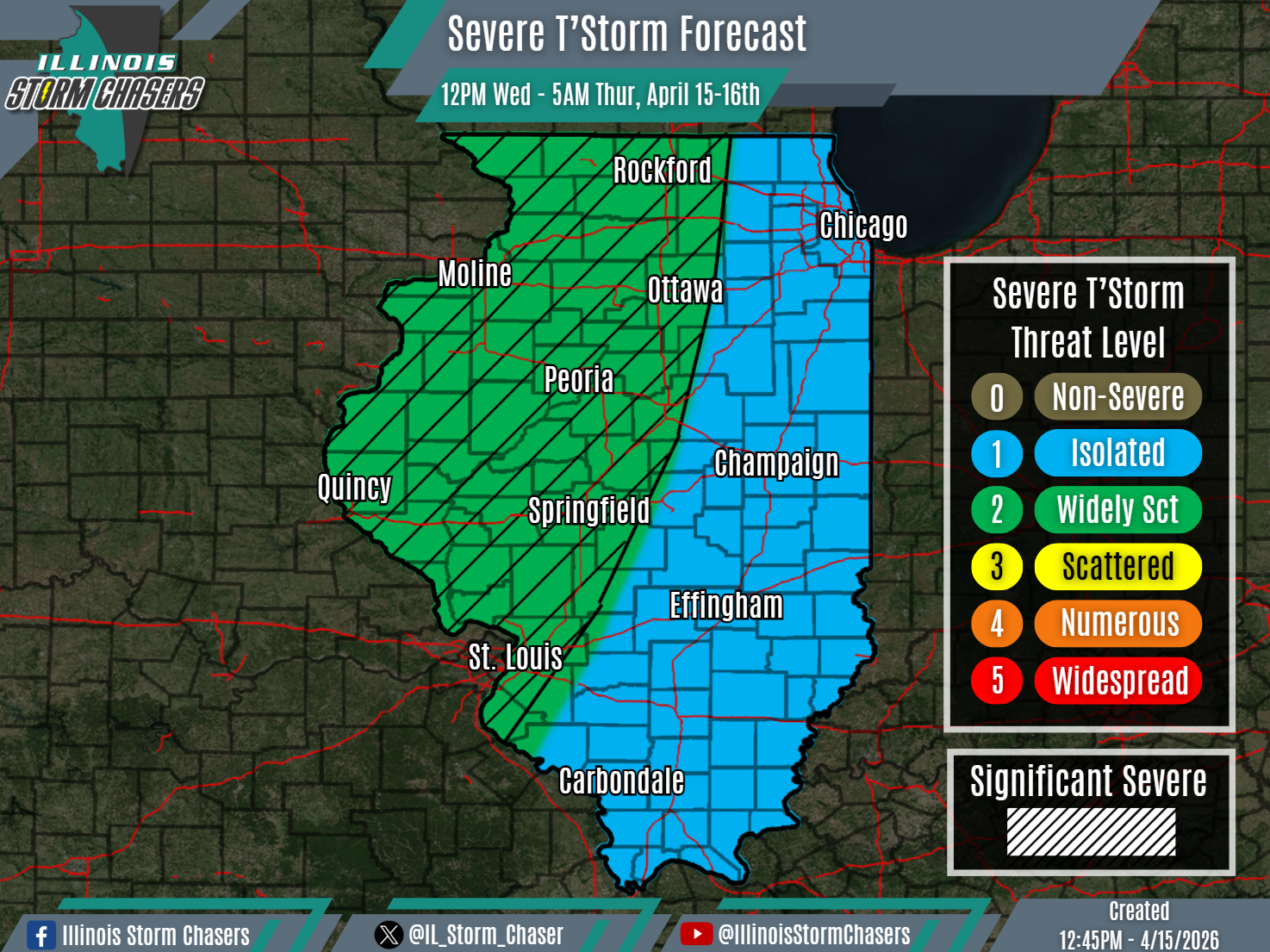
•With this update cycle, on the forecast for today/tonight, we have upgraded roughly the western half of the state to a level 2 severe t’storm threat. Across this area, slightly higher severe t’storm coverage will be possible.
⏰📍Timing & Location…
•This Afternoon – Early Thursday Morning, April 15-16th: Much of Illinois.
⚡️Hazards…
•A level 1 to 2 severe t’storm threat is in place across much of Illinois from this afternoon through early Thursday morning, for the threat of isolated to widely scattered severe t’storms. All modes of severe weather will be possible, including large hail, damaging winds and a couple of tornadoes. Some significant severe t’storms will be possible across roughly Northwestern and Western Illinois as well, capable of producing very large hail (2.00″+) and/or a strong tornado.
✔️Summary…
•This Afternoon – Early Thursday Morning… Areas of rain and t’storm activity have traversed the state overnight last night, this morning and now into this afternoon. Additional rounds of rain and t’storm activity can be expected to track across the state through the remainder of today and through tonight. Some of this activity may be severe, of focus being the a more organized and widespread round of activity expected this evening on into tonight.

Your forecasts are like a puzzle that change 4 times a day