
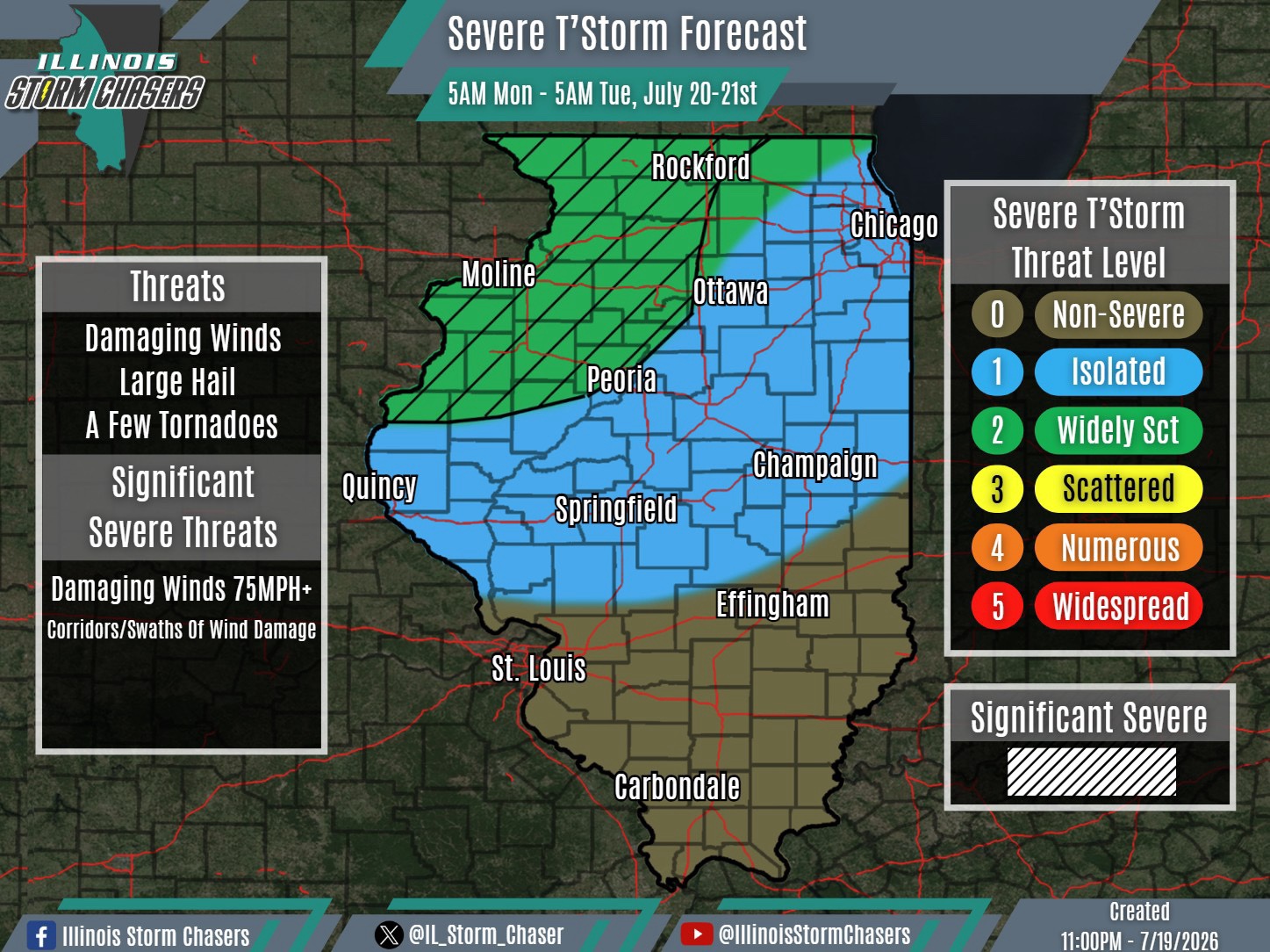
(11:00PM – Sunday, July 19th, 2026)
A severe weather threat is possible across a large chunk of the state on Monday/Monday night, with potentially two rounds of activity being possible. However, it should be noted that there is currently uncertainty on the exact evolution.
There are signs that an initial loose complex of rain/t’storm activity may dive into portions of Northern Illinois around mid-morning to midday on Monday. Should this occur, this complex would continue southward into portions of Central Illinois into Monday afternoon. An isolated severe weather threat may be possible, should this initial round come to fruition.
Whether or not the first round of activity occurs, a main round of severe t’storm development is expected across portions of Iowa, Minnesota and Wisconsin on Monday afternoon. This activity will track southeastward, eventually traversing portions of Northern Illinois from late Monday afternoon into early Monday night, potentially making it into portions of Central Illinois overnight Monday night. The main severe weather threat for the day would accompany this activity, on the order of isolated to widely scattered coverage.
We will monitor trends overnight tonight/Monday morning. Expected specific details to be fine tuned on the Monday morning forecast update cycle.
#ilwx #severeweather
