
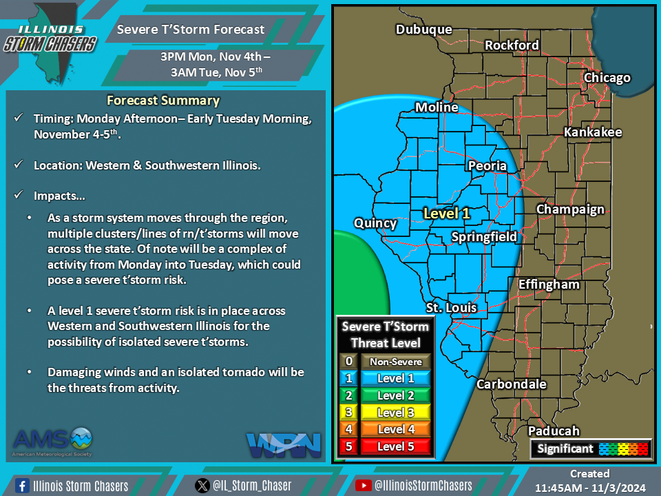
(11:45AM – Sunday, November 3rd, 2024) As a storm system moves through the region, several rounds of rain and t’storms can be expected across the state through early Wednesday. Of note will be a round of activity from Monday afternoon into early Tuesday morning, which may pose a severe t’storm risk.
Timing…
•Monday Afternoon – Tuesday Morning, November 4-5th.
Location…
•Western and Southwestern Illinois.
Impacts…
•A broken complex of rain/t’storm activity from Monday afternoon into early Tuesday morning could pose a severe t’storm risk.
•A level 1 severe t’storm risk is in place across Western and Southwestern Illinois from Monday afternoon through early Tuesday morning for the possibility of isolated severe t’storms. Damaging winds and an isolated tornado will be the threats from activity.
Discussion…
•As a storm system moves through the region, multiple clusters/lines of rain/t’storms will move across the state. Of note will be a complex of activity from Monday into Tuesday, which could pose a severe t’storm risk. While greater instability will preclude a higher severe t’storm threat, ample moisture, wind shear, forcing, and a strong low level jet will all prove sufficient for a lower end severe t’storm threat during this period.
