
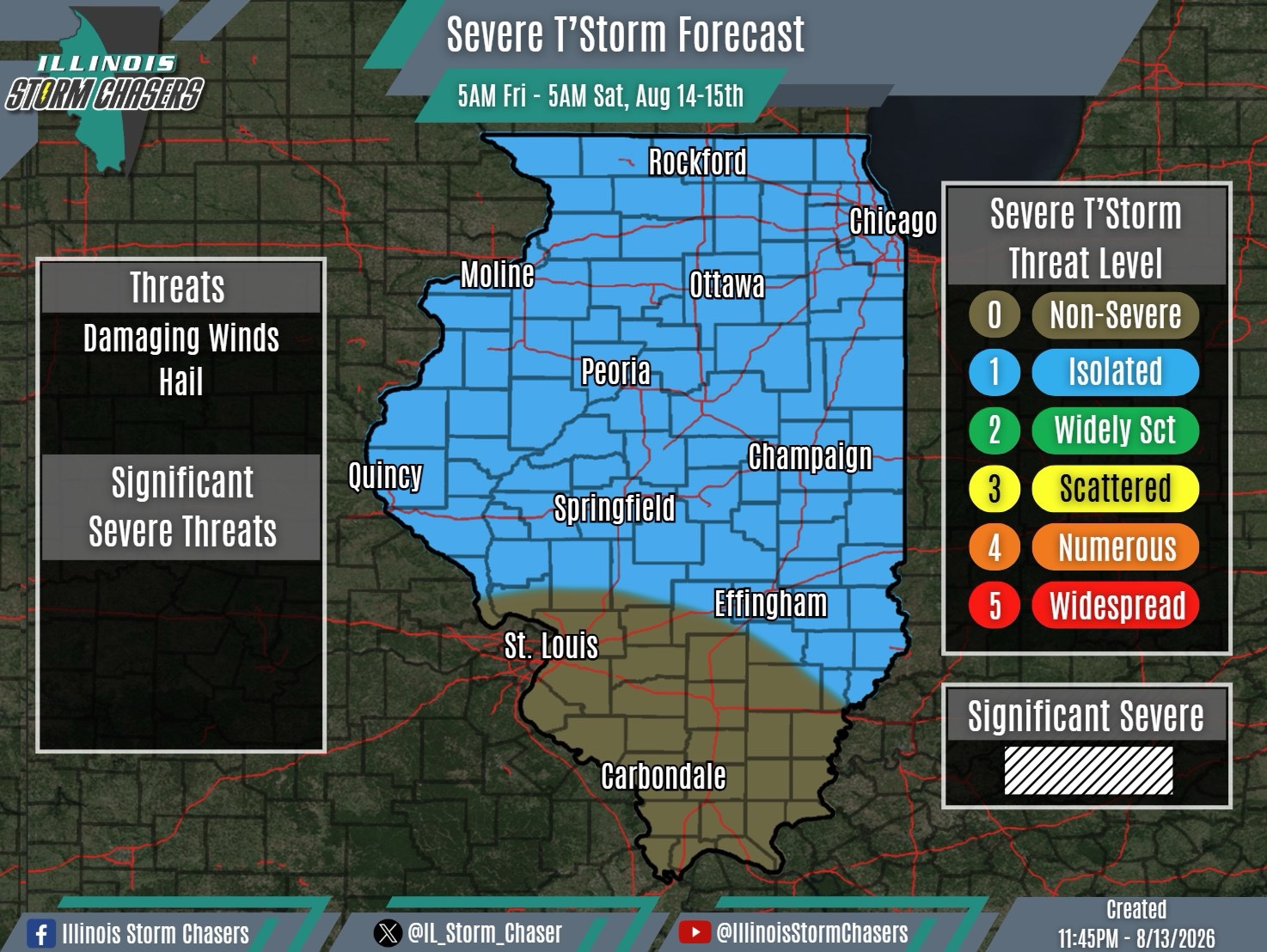
(11:45PM – Thursday, August 13th, 2026)
Severe Weather Threat Friday/Friday Night ⚡
A messy and uncertain scenario is expected across the state on Friday and Friday night, with multiple rounds of rain/t’storm activity expected and uncertainty regarding exactly how each round will evolve.
Lingering t’storm activity will be ongoing across portions of the state Friday morning, especially across Central Illinois. This activity will generally be in a weakening and fading phase, gradually diminishing as the morning progresses.
Another round of t’storm activity is expected to traverse portions of Northern and Central Illinois from Friday morning through Friday afternoon.
Lastly, a third and final round of t’storms is expected to enter the state from the west Friday evening and night, potentially traversing portions of Northern and Central Illinois. There is some support for this activity to be a complex (MCS) as it moves across the area.
There is still a fair amount of uncertainty regarding especially the second and third rounds of activity. As details become better ironed out, both the timing and placement of these rounds could change. There may be a severe weather threat with each round of activity, generally on the order of isolated coverage.
#ilwx #severeweather
