
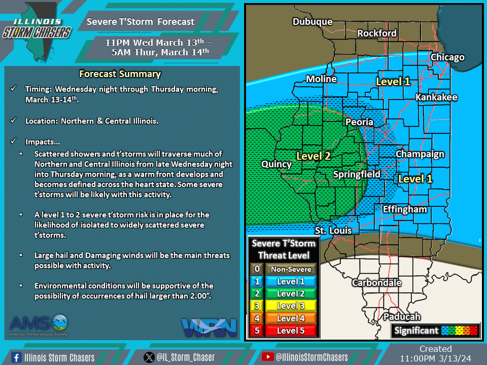
(11:00PM – Wednesday, March 13th, 2024) Wednesday night update on a storm system moving through the region, bringing a few rounds of showers and t’storms, with the potential for severe t’storms, to portions of the state from tonight through early Friday morning.
Update…
•With this update, only minor placemet adjustments to severe t’storm probabilities were needed on tonight’s and Thursday/Thursday night’s severe t’storm forecasts. These adjustments were made based on the latest trends in weather model guidance.
Timing & Location…
•Wednesday Night – Thursday Morning, March 13-14th: Northern & Central Illinois.
•Thursday Morning – Early Friday Morning, March 14-15th: Much of Illinois.
Impacts…
•A level 1 to 2 severe t’storm risk is in place across Northern and Central Illinois from tonight through Thursday morning. Isolated to widely scattered severe t’storms will be likely, posing a risk of large hail and damaging winds. Environmental conditions will be supportive of the possibility of occurrences of hail larger than 2.00”.
•A level 1 to 2 severe t’storm risk is in place across much of Illinois from Thursday morning through early Friday morning. Isolated to widely scattered severe t’storms will be likely, posing a risk of large hail, damaging winds, and an isolated tornado. Environmental conditions will be supportive of the possibility of occurrences of hail larger than 2.00”.

