
(11:45PM – Monday, August 10th, 2026)
Severe Weather Threat Tuesday/Tuesday Night ⚡
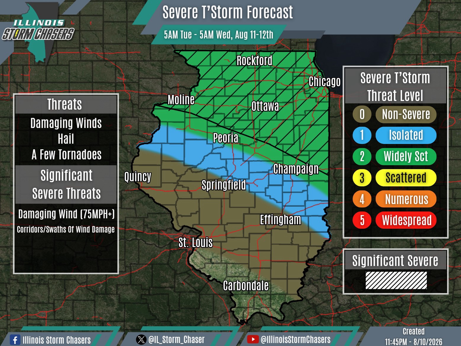
A severe weather threat will exist once again on Tuesday, potentially significant. However, the extent of the threat remains conditional as of this forecast. There is still considerable uncertainty regarding how the day will evolve, which precludes outlining a higher severe weather threat with this forecast cycle.
With a wave/disturbance working across the Northern Plains tonight (Monday night), weather guidance suggests an MCS will develop from ongoing and further development of severe t’storm activity across South Dakota and vicinity. Up through the midnight hour, however, real-time observations have yet to show that evolution occurring, casting some doubt on guidance expectations.
Additionally, a few showers/t’storms are developing across Southern Wisconsin, Northern Illinois and Northwestern Illinois as of this forecast issuance. There is modest support for additional development through the remainder of tonight and into Tuesday morning, with even some potential for activity to grow upscale. If that occurs and activity becomes more widespread or lingers into Tuesday, it could become detrimental to the daytime severe weather potential.
In other words, there are two important variables to watch overnight and into early Tuesday morning that could greatly impact how Tuesday’s forecast unfolds:
- MCS development upstream across the Northern Plains and how it evolves toward the region.
- Whether ongoing/local development across Southern Wisconsin and Northern Illinois becomes more organized or widespread overnight and into Tuesday morning.
There is certainly a scenario in which an MCS tracks across Northern and perhaps portions of Central Illinois Tuesday morning into the afternoon, potentially accompanied by a significant severe weather threat. However, expectations should be held in check for now given the uncertainties outlined above.
Real-time observations will continue to be closely monitored overnight and into early Tuesday morning. An earlier-than-normal forecast update will be issued Tuesday morning as the situation becomes clearer.
#ilwx #severeweather
