
(11:45PM – Monday, July 8th, 2024) Monday night update on the remnants of Hurricane Beryl, which will move through the region from early Tuesday into early Wednesday. Heavy rainfall, flooding, severe t’storms, and high winds will be likely across the state.
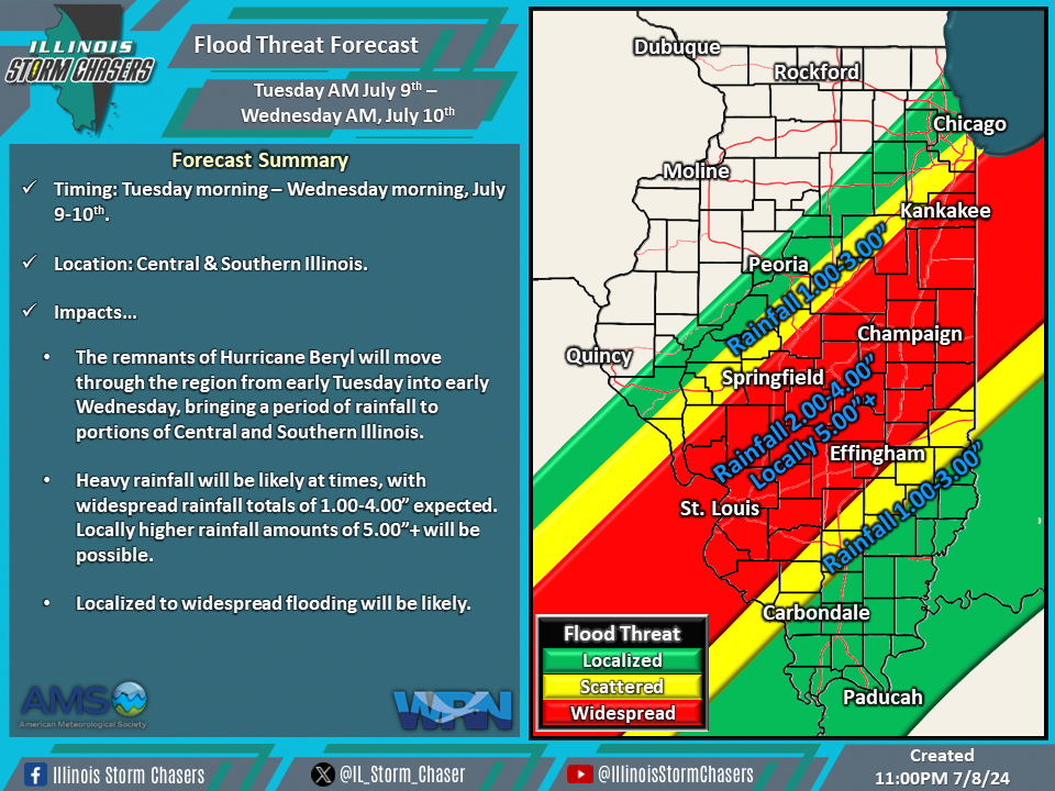
Timing…
•Early Tuesday Morning – Early Wednesday Morning, July 9-10th.
Location…
•Much of Illinois.
Impacts…
•Heavy rainfall will be likely, with widespread rainfall totals of 1.00-4.00” expected across much of Northeastern, Central, and Southern Illinois. Locally higher rainfall totals of 5.00″+ will be possible.
•Localized to widespread flooding will be likely.
•A level 1 to 2 severe t’storm risk is in place across Southern Illinois from early Tuesday morning through early Tuesday for the likelihood of isolated to widely scattered severe t’storms. Damaging winds and a few tornados will be the threats from activity. Environmental conditions will be supportive of the possibility of occurrences of strong tornadoes.
•Gusty winds will be likely across portions of Northeastern, Central, and Southern Illinois from Tuesday afternoon through Wednesday morning. Wind gusts ranging from 30-45MPH are expected. Locally higher wind gusts are possible.
Discussion…
•As the remnants of Hurricane Beryl track northeastward through the region and across the state, multiple modes of weather are expected across the state, some of which may be significant. Remnant tropical cyclones are notorious for featuring an axis of heavy rainfall/flooding along and north of their track and a severe t’storm threat east/southeast of their track. Beryl will be no different, with the aforementioned expected to be the case across the state.


