
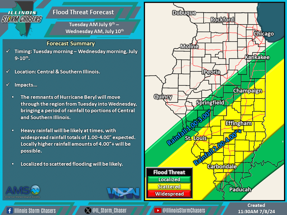
(11:30AM – Monday, July 8th, 2024) Monday morning update on the remnants of Hurricane Beryl, which will move through the region from Tuesday into Wednesday, bringing along with it the likelihood for a period of rainfall and severe t’storm potential across portions of the state. Heavy rainfall totals, flooding, and severe t’storms will be possible across affected areas during this time.
Timing…
•Early Tuesday Morning – Early Wednesday Morning, July 9-10th.
Location…
•Central & Southern Illinois.
Impacts…
•Heavy rainfall will be likely at times, with widespread rainfall totals of 1.00-4.00” expected. Locally higher rainfall totals of 4.00″+ will be possible.
•Localized to scattered flooding will be likely.
•A level 1 severe t’storm risk is in place across Southern Illinois from early Tuesday morning through early Tuesday for the possibility of isolated severe t’storms. Damaging winds and a few tornados will be the threats from activity.
Discussion…
•As the remnants of Hurricane Beryl track northeastward through the region, a large area of rain, with embedded heavier rainfall and t’storms, will traverse portions of Central and Southern Illinois from early Tuesday morning through early Wednesday morning. A widespread corridor of heavy rainfall totals and flooding can be expected.
•Remnant tropical cyclones are notorious for featuring a severe t’storm threat along and just south of their track, and the remnants of Hurricane Beryl will be no different. The threat for severe t’storm activity is expected across Southern Illinois from early Tuesday morning through early Tuesday night.

