
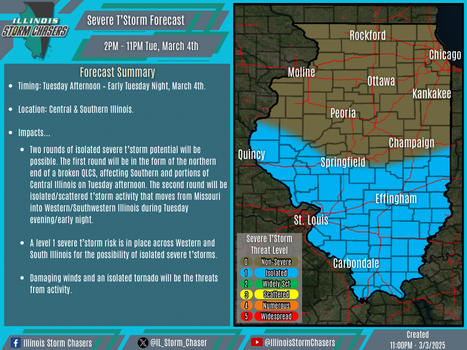
(11:00PM – Monday, March 3rd, 2025) Monday night update on a strong late winter/early spring storm system will affect the state over the next few days. A low-end severe t’storm threat will accompany this storm system on Tuesday across portions of the state.
Timing…
•Tuesday Afternoon – Early Tuesday Night, March 4th.
Location…
•Central & Southern Illinois.
Impacts…
•Two rounds of isolated severe t’storm potential will be possible. The first round will be in the form of the northern end of a broken QLCS, affecting Southern and portions of Central Illinois on Tuesday afternoon. The second round will be isolated/scattered t’storm activity that moves from Missouri into Western/Southwestern Illinois during Tuesday evening/early night.
•A level 1 severe t’storm risk is in place across Western and South Illinois for the possibility of isolated severe t’storms.
•Damaging winds and an isolated tornado will be the threats from activity.
Update…
•With this update, little changes were needed, as the going forecast is on track.
Discussion…
•As a strong late winter/early spring storm system moves through the region over the next few days, a low-end severe t’storm threat will accompany this storm system on Tuesday across portions of the state. Two rounds of isolated severe t’storm potential will be possible. The first round will be in the form of the northern end of a broken QLCS, affecting Southern and portions of Central Illinois on Tuesday afternoon. The second round will be isolated/scattered t’storm activity that moves from Missouri into Western/Southwestern Illinois during Tuesday evening/early night. While parameters, such as instability and moisture, will be meager, shear and forcing will be ample. In other words, this is a fairly common early-season high shear/low instability potential. While many times severe t’storm potential with this sort of setup is quite low, but it is enough of a threat to be worthy of a mention, and can be sneaky on occasion.
