
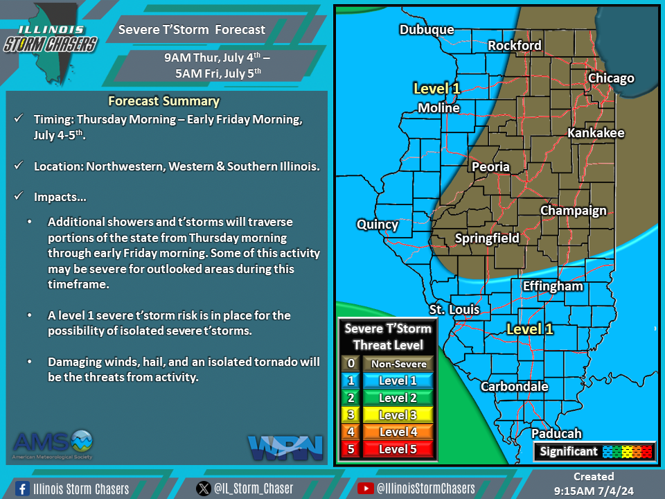
(9:15AM – Thursday, July 4th, 2024) Thursday morning update on two storm systems that will continue to move through the region through Friday, bringing additional rounds of rain and t’storms to the state through early Friday morning. Severe t’storms will be possible with some of this activity across outlooked areas during portions of this timeframe.
Update…
•With this update on the severe t’storm forecast for today/tonight, little to no changes were needed. The going forecast is on track.
Timing & Location…
•This Morning – Early Friday Morning, July 4-5th: Northwestern, Western & Southern Illinois.
Impacts…
•A level 1 severe t’storm risk is in place across much of Illinois from this morning through early Friday morning for the possibility of isolated severe t’storms. Damaging winds, hail, and an isolated tornado will be the threats from activity.
Discussion…
•As two storm systems continue to move through the region through Friday, additional rounds of rain/t’storms can be expected across the state through early Friday morning.
•For this morning through early Friday morning, a few clusters of showers/t’storms can be expected to traverse portions of the state throughout this timeframe, especially across the southern half of the state. Environmental conditions will be somewhat supportive of severe t’storm activity; thus, a level 1/isolated severe t’storm threat is in place across portions of the state.
