
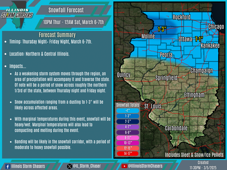
(11:30PM – Wednesday, March 5th, 2025) As a weakening storm system moves through the region, an area of precipitation will accompany it and traverse the state. Of note will be a period of snow across roughly the northern 1/3rd of the state, between Thursday night and Friday night.
Timing…
•Thursday Night – Friday Night, March 6-7th.
Location…
•Northern & Central Illinois.
Impacts…
•Snow accumulation ranging from a dusting to 1-3″ will be likely across affected areas.
•With marginal temperatures during this event, snowfall will be heavy/wet. Marginal temperatures will also lead to compacting and melting during the event.
•Banding will be likely in the snowfall corridor, with a period of moderate to heavy snowfall possible.
Discussion…
•As a storm system moves through the region, it will be in a steadily weakening/dampening phase. Even with that, precipitation accompanying it will traverse the state. Of focus will be roughly the northern 1/3rd of the state, where a period of snow will be likely. While temperatures will be marginal, and likely hovering around or just above freezing for the duration of the event, dynamic cooling will help to keep precipitation in the form of snow. Weather guidance and associated soundings are favorable for banded snowfall, and potentially a period of moderate to heavy snowfall in a corridor within the main larger snowfall axis. While snowfall accumulation as a whole will be minor overall across affected areas, greatest accumulations will likely be where the peak of this banding occurs. As of this time, that is most favored across portions of Northwestern Illinois and in the vicinity of the Quad Cities…fading with eastward extent across Northern Illinois.
