
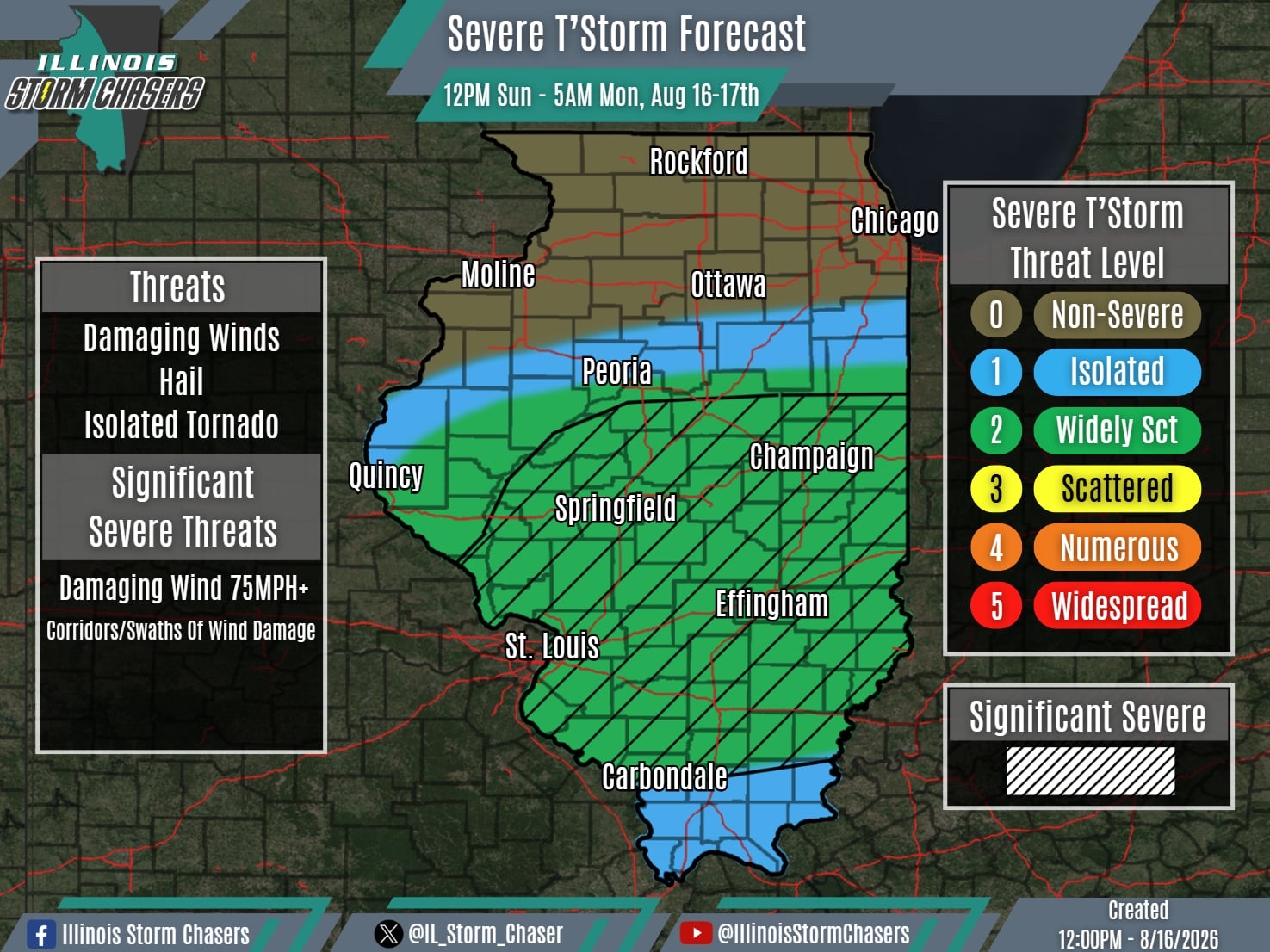
(12:00PM – Sunday, August 16th, 2026)
Severe Weather Threat Today/Tonight⚡
*Sunday Midday Update*
A few showers t’storms have been ongoing across portions of Central and Southern this morning, residual activity from overnight.
More of note is a complex (MCS) of t’storms that has moved from Northern Missouri into Western Illinois as of midday. This complex will track eastward across Central Illinois through the afternoon hours, posing a severe weather risk, with damaging winds being the greatest threat.
Further south, additional scattered t’storms/severe t’storms are expected to develop across Central/Southern Missouri this afternoon, perhaps in the vicinity of the outflow boundary from the northern complex. This activity will have the opportunity to grow upscale int a complex, which would then traverse Southern Illinois from later this afternoon into early tonight. A severe weather risk will accompany this activity, with damaging winds being the greatest threat.
#ilwx #severeweather
