
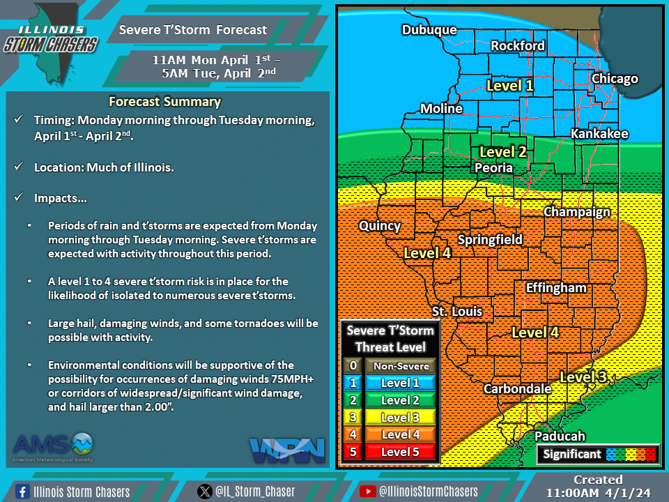
(11:00AM – Monday, April 1st, 2024) Monday morning update on the storm system moving through the region that will bring additional rounds of rain, t’storm, and severe t’storm activity to portions of the state through late Tuesday.
Update…
•With this update, we have increased and expanded severe t’storm probabilities across portions of the state on the severe t’storm forecast for today/tonight. These changes were based on the latest trends and increasing confidence in the scenario expected to unfold.
•With this update, we have slightly adjusted severe t’storm probabilities on the severe t’storm forecast for Tuesday, based ont he latest trends.
Timing & Location…
•Monday Morning – Tuesday Morning, April 1-2nd: Much of Illinois
•Tuesday Morning – Tuesday Afternoon, April 2nd: Eastern & Southern Illinois
Impacts…
•A level 1 to 4 severe t’storm risk is in place across much of Illinois from this morning through Tuesday morning. Isolated to numerous severe t’storms are expected, posing a risk of large hail, damaging winds, and some tornadoes. Environmental conditions will be supportive of the possibility for occurrences of damaging winds 75MPH+ or corridors of widespread/significant wind damage and hail larger than 2.00”.
•A level 1 to 2 severe t’storm risk is in place across Eastern and Southern Illinois from Tuesday morning through late Tuesday afternoon. Isolated to widely scattered severe t’storms will be likely, posing a risk of large hail, damaging winds, and an isolated tornado.

