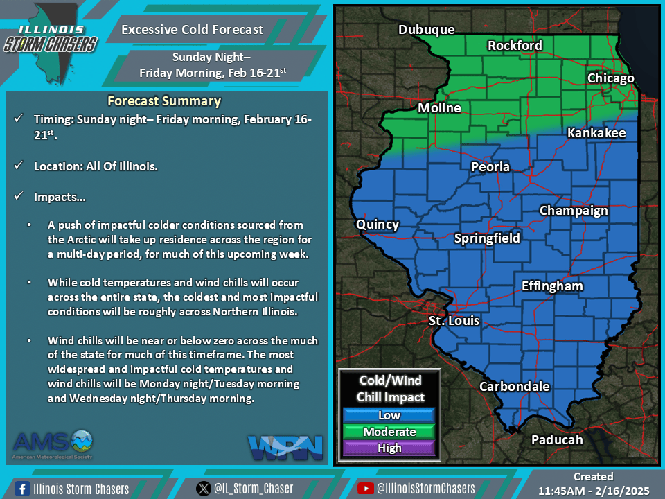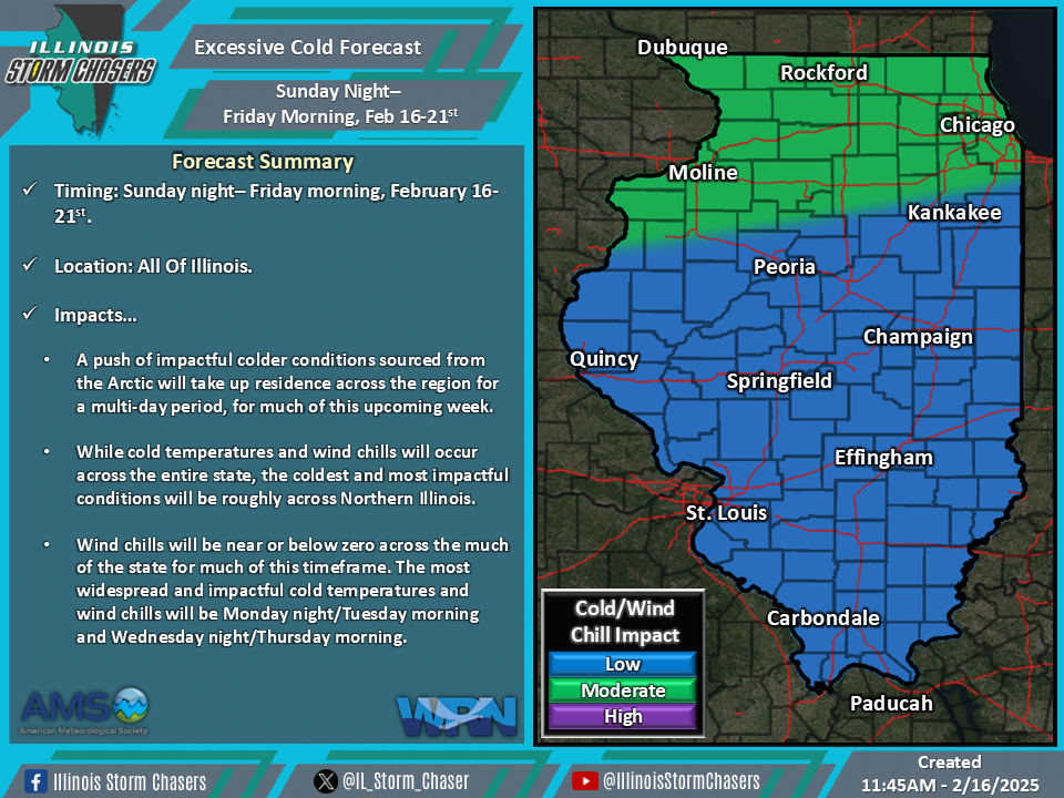
(11:45AM – Sunday, February 16th, 2025) As a TPV (Tropospheric Polar Vortex) digs in across the central and eastern half of Canada and U.S., a significant chunk of deep Artic air will settle into the region for this timeframe. This will lead to a multi-day period of cold and impactful temperatures and wind chills across the state from tonight through Friday morning.
Timing…
•Tonight – Friday Morning, February 16-21st.
Location…
•All Of Illinois.
Impacts…
•Cold temperatures and wind chills will be likely across the state on a daily/nightly basis during this timeframe, with nightly conditions being the most impactful.
•Wind chills will generally be around/below zero for the entire timeframe from tonight through Friday morning across much of the state.
•Near zero to below zero overnight/early morning low temperatures can be expected on a nightly basis across Northern Illinois, with a gradual expansion to include Central and Southern Illinois by mid to late week.
•Wind chills of 0 to -25 will be common across the state much of this timeframe.
•The coldest temperatures and wind chills on a more widespread level across the state will be Monday night/Tuesday morning and Wednesday night/Thursday morning. During these times, peak wind chills of -10 to -30 will be most widespread across the state.