
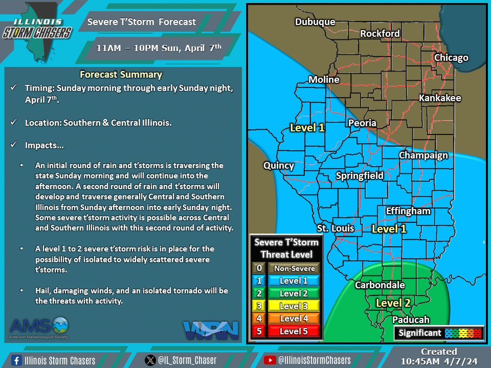
(10:45AM – Sunday, April 7th, 2024) Sunday morning update on a storm system that will move through the region and bring a few rounds of showers and t’storms, with the potential for severe t’storms, to a large portion of the state from Sunday morning through early Sunday night.
Update…
•With this update, we had expanded level 1 severe t’storm risk probabilities severe t’storm forecast for Sunday. This change was made to account for increased confidence in a low/conditional isolated severe t’storm threat along the front further north of the primary risk corridor further south.
Timing…
•Sunday Morning – Early Sunday Night, April 7th.
Location…
•Central & Southern Illinois.
Impacts…
•An initial round of rain and t’storms is traversing the state Sunday morning and will continue into the afternoon. A second round of rain and t’storms will develop and traverse generally Central and Southern Illinois from Sunday afternoon into early Sunday night. Some severe t’storm activity is possible across Central and Southern Illinois with this second round of activity.
•A level 1 to 2 severe t’storm risk is in place for the possibility of isolated to widely scattered severe t’storms.
•Hail, damaging winds, and an isolated tornado will be the threats with activity.
