
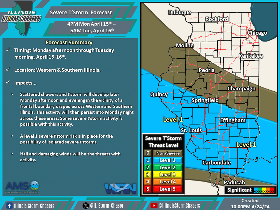
(10:00PM – Sunday, April 14th, 2024) A storm system will move through the region, bringing several rounds of rain and t’storms, with the potential for severe t’storms, to portions of the state from Monday into Wednesday.
Timing & Location…
•Monday Afternoon – Tuesday Morning, April 15-16th: Central & Southern Illinois.
•Tuesday Morning – Wednesday Morning, April 16-17th: All of Illinois.
•Wednesday Morning – Wednesday Afternoon, April 17th: TBD.
Impacts…
•A level 1 severe t’storm risk is in place across Central and Southern Illinois from Monday afternoon through Tuesday morning. Scattered showers and t’storm will develop later Monday afternoon and evening in the vicinity of a frontal boundary draped across Western and Southern Illinois. This activity will then persist into Monday night across these areas.
•A level 1 to 2 severe t’storm risk is in place across all of Illinois from Tuesday morning through Wednesday morning. One or more rounds of showers and t’storms will develop across Iowa and Missouri, then traverse the state, especially from Tuesday afternoon through Tuesday night.
•A severe t’storm threat will also exist Wednesday morning through Wednesday afternoon. More specific information regarding this potential is to come in future updates.

