
(10:00PM – Friday, July 12th, 2024) With a “Ring of Fire” pattern in place, multiple disturbances will move through the region with an enhanced upper level flow in place atop ridging across the Inter-Mountain West and Central U.S. Clusters of rain/t’storms will be likely on a daily/nightly basis across portions of the region and state during this period. Severe t’storms will be possible with some of this activity across specific outlooked areas during this timeframe.
Timing & Location…
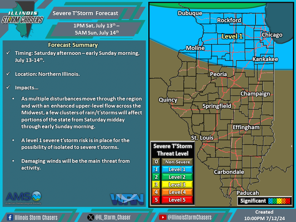
•Saturday Afternoon – Early Sunday Morning, July 13-14th: Northern Illinois.
•Early Sunday Morning – Early Monday Morning, July 14-15th: Northern Illinois.
Impacts…
•A level 1 severe t’storm risk is in place across Northern Illinois from Saturday afternoon through early Sunday morning for the possibility of isolated severe t’storms. Damaging winds will be the main threat from activity.
•A level 1 severe t’storm risk is in place across Northern Illinois from early Sunday morning through early Monday morning for the possibility of isolated to severe t’storms. Damaging winds awill be the main threat from activity.
Discussion…
•Clusters of rain/t’storms can be expected across the regiona nd state on a daily/nightly basis during this period. Severe t’storms will be possible with some of this activity across specific outlooked areas during this timeframe.
•For Saturday midday through early Sunday morning, one or more clusters of rain/t’storms will be possible across the state. Environmental conditions will be supportive of a severe t’storm threat with some of this activity across Northern Illinois.
•For early Sunday morning through early Monday morning, a few clusters of rain/t’storms will be possible across the state. Environmental conditions will be supportive of a severe t’storm threat with some of this activity across Northern Illinois.

