
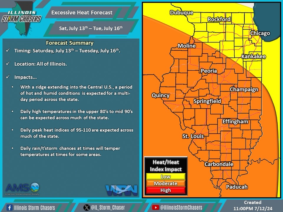
(7:30AM – Saturday, July 13th, 2024) As extends from the Inter-Mountain West into the Central U.S., a multi-day period of hot and humid conditions is expected across the region and state. These conditions are expected over a multi-day period from today through Tuesday, July 13-16th.
Timing & Location…
•Saturday, July 13th – Tuesday, July 16th: All Of Illinois.
Impacts…
•Daily high temperatures in the upper 80’s to mid 90’s can be expected across much of the state.
•Daily heat index values between 95-110 can be expected across much of the state.
•Daily shower/t’storm chances across portions of the state will temper conditions in some areas at times.
Discussion…
•A ridge that that been in place across the Western U.S. is becoming reorganized in the Inter-Mountain West, and is centering out into the Central U.S. This will bring a multi-day period of hot and humid conditions to the state from today through Tuesday. Daily chances of showers/t’storms across the state may temper conditions for some areas at times. This period will feature the most humid conditions and highest heat index values of the summer to date.
Short Term/Three-Day Forecast…
•Saturday, July 13th: High temperatures of 86-93 across Northwestern, Western, and Southwestern Illinois, with peak heat indices of 93-100.
•Sunday, July 14th: High temperatures of 88-95 across the state, with peak heat indices of 95-107.
•Monday, July 15th: High temperatures of 88-97 across the state, with peak heat indices of 95-110.
•Forecasts for later dates will be provided in future updates.
