
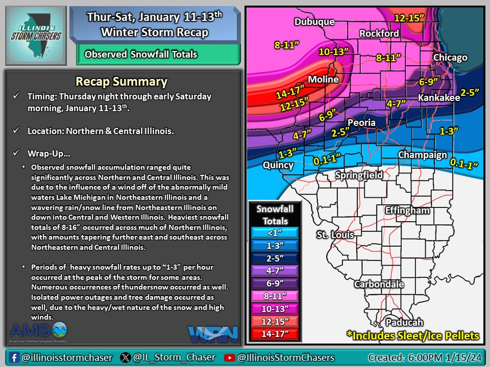
(6:00PM – Monday, January 15th, 2024) A brief recap of the winter storm that affected the state from Thursday night, January 11th, through early Saturday morning, January 13th. This winter storm brought periods of precipitation to the state during this time, producing accumulating snow, rain, and high winds.
Recap…
•Observed snowfall accumulation ranged quite significantly across Northern and Central Illinois. This was due to the influence of a wind off of the abnormally mild waters Lake Michigan in Northeastern Illinois and a wavering rain/snow line from Northeastern Illinois on down into Central and Western Illinois. Heaviest snowfall totals of 8-16” occurred across much of Northern Illinois, with amounts tapering further east and southeast across Northeastern and Central Illinois.
•Periods of heavy snowfall rates up to ~1-3” per hour occurred at the peak of the storm for some areas.
•Numerous occurences of thundersnow occurred across Northern and Central Illinois.
•Isolated power outages and tree damage occurred as well, due to the combination of the heavy and wet nature of the snow and high winds.
•Gusty winds of 30-55MPH occurred on the backside of the winter storm across much of the state.
