
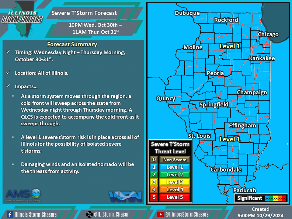
(9:00PM – Tuesday, October 29th, 2024) As a storm system moves through the region, along with it will come a cold front which will sweep across the state from Wednesday night through Thursday morning. This cold front will likely to be accompanied by a QLCS, which will feature some severe t’storm threat.
Timing…
•Wednesday Night – Thursday Morning, October 30-31st.
Location…
•All of Illinois.
Impacts…
•A QLCS will accompany a cold front, as it sweeps across the state from Wednesday night through Thursday morning.
•A level 1 severe t’storm risk is in place across all of Illinois from Wednesday night through Thursday morning for the possibility of isolated severe t’storms. Damaging winds and an isolated tornado will be the threats from activity.
Discussion…
•As a storm system moves through the region, a cold front will sweep across the state from Wednesday night through Thursday morning. A QLCS is expected to accompany the cold front as it sweeps through. While greater instability and moisture will preclude a higher severe t’storm threat, ample wind shear, forcing, and a strong low level jet will all prove sufficient for a lower end severe t’storm threat with the expected QLCS.
