
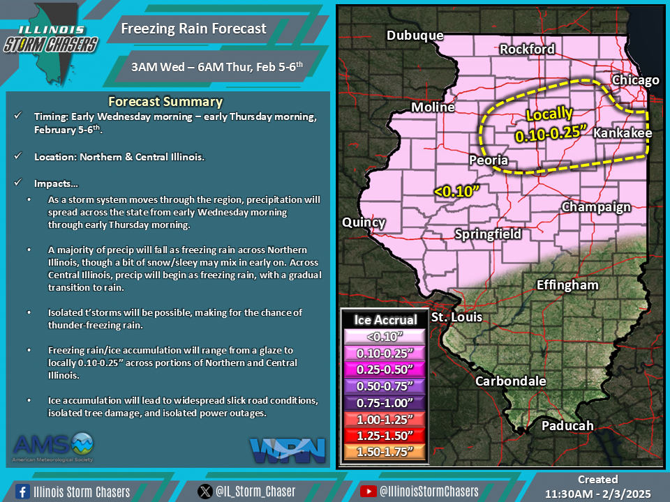
(11:30AM – Monday, February 3rd, 2025) As a storm system moves through the region, precipitation will traverse a large portion of the state from early Wednesday morning through early Thursday morning. Freezing rain will be possible across portions of Central and especially northern Illinois during this time, with ice accumulation likely.
Timing…
•Early Wednesday morning – Early Thursday morning, February 5-6th.
Location…
•Northern & Central Illinois.
Impacts…
•Freezing rain/ice accumulation will range from a glaze to locally 0.10-0.25” across portions of Northern and Central Illinois.
•Isolated t’storms will be possible, making for the chance of thunder-freezing rain.
•Ice accumulation will lead to widespread slick road conditions, isolated tree damage, and isolated power outages.
Discussion…
•As a storm system moves through the region, precipitation will spread across the state from early Wednesday morning through early Thursday morning.
•A majority of precipitation will fall as freezing rain across Northern Illinois, though a bit of snow/sleey may mix in early on. Across Central Illinois, precipitation will begin as freezing rain, with a gradual transition to rain.
•Exact ice accumulation totals are still in question at this range. Accumulation will be dependent on how quickly temperatures rise, if temperatures hover around freezing or just below when they level off, and exact wet bulb temperatures. As these fine details are determined, adjustments in forecast ice accumulations will be possible in future updates.
