(11:30PM – Tuesday, March 12th, 2024) Tuesday night update on a storm system that will move through the region and bring a few rounds of showers and t’storms, with the potential for severe t’storms, to portions of the state from Wednesday afternoon through Friday morning.
Update…
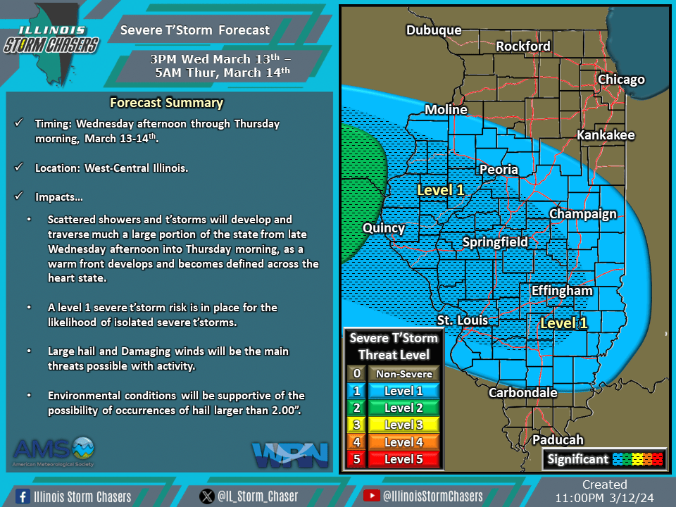
•With this update, we have added significant severe probabilities to Wednesday/Wednesday night’s severe t’storm forecast, as the potential for a few instances of very large hail is looking possible.
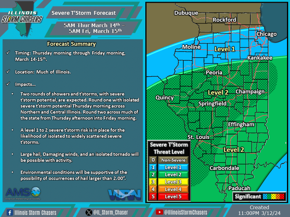
•With this update, we have issued our first severe t’storm forecast for Thursday/Thursday night.
Timing & Location…
•Wednesday Afternoon – Thursday Morning, March 13-14th: West-Central Illinois.
•Thursday Morning – Friday Morning, March 14-15th: Much of Illinois.
Impacts…
•A level 1 severe t’storm risk is in place across West-Central Illinois from Wednesday afternoon through Thursday morning. Isolated severe t’storms will be likely, posing a risk of hail and damaging winds. Environmental conditions will be supportive of the possibility of occurrences of hail larger than 2.00”.
•A level 1 to 2 severe t’storm risk is in place across much of Illinois from Thursday morning through Friday morning. Isolated to widely scattered severe t’storms will be likely, posing a risk of large hail, damaging winds, and an isolated tornado. Environmental conditions will be supportive of the possibility of occurrences of hail larger than 2.00”.