
(11:00AM – Wednesday, March 4th, 2026) Continued severe t’storm threat thru Thursday morning…
⚠️Update…
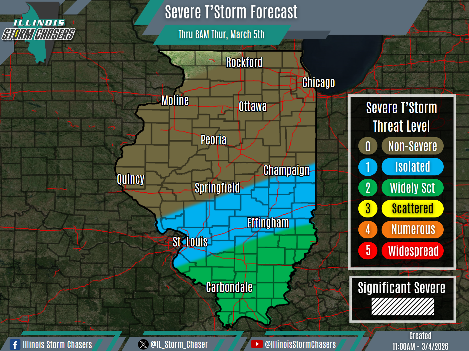
•With this update, we have upgraded severe t’storm probabilities to a level 2 risk across portions of Southern Illinois, to account for what will be a slightly higher coverage severe t’storm potential.
⏰📍Timing & Location…
•This Morning – Thursday Morning, March 4-5th: Southern Illinois.
⚡️Hazards…
•A level 1 to 2 severe t’storm threat is in place across Southern Illinois from this morning through Thursday morning, for the threat of isolated to widely scattered severe t’storms. Hail, damaging winds, and an isolated tornado will be the main threats with activity.
✔️Summary…
•As multiple disturbances and then a main through eject out through the region, additional rounds of rain and t’storm activity can be expected across the state through Thursday. A severe t’storm threat will be likely with some of this activity across Southern Illinois during this period.
•This Morning-Thursday morning… In the wake of waves of rain and t’storm activity overnight and into this morning, additional waves of widespread rain and t’storm activity will be likely across the state through Thursday. A severe t’storm threat will be possible across Southern Illinois with each wave of activity.
