
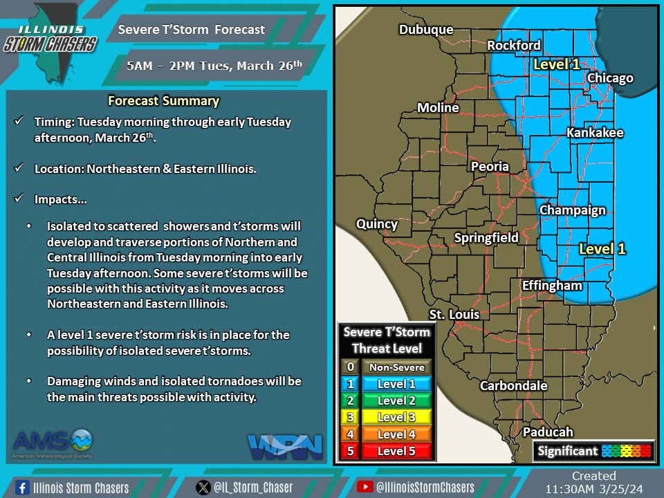
(11:30AM – Monday, March 25th, 2024) A storm system moving through the region is bringing several rounds of rain, t’storms, and high winds to the state today into Tuesday. Of note will be a round of showers and t’storms, with the potential for some severe t’storms, expected across portions of the state from Tuesday morning through early Tuesday afternoon.
Timing…
•Tuesday Morning – Early Tuesday Afternoon, March 26th.
Location…
•Northeastern & Eastern Illinois.
Impacts…
•Isolated to scattered showers and t’storms will develop and traverse portions of Northern and Central Illinois from Tuesday morning into early Tuesday afternoon. Some severe t’storms will be possible with this activity as it moves across Northeastern and Eastern Illinois.
•A level 1 severe t’storm risk is in place for the possibility of isolated severe t’storms.
•Damaging winds and isolated tornadoes will be the main threats possible with activity.
