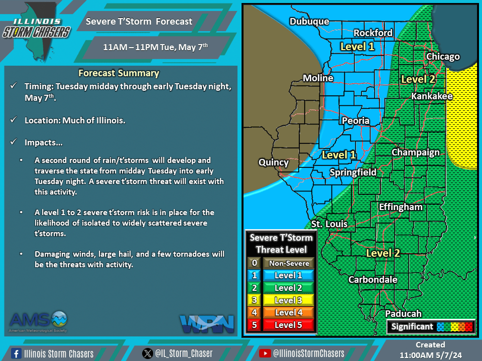
(11:45AM – Tuesday, May 7th, 2024) Tuesday morning update on two storm systems that will move through the region, bringing several rounds of rain and t’storms, with the likelihood of severe t’storms, to portions of the state from today through Wednesday.
Update…
•With this update, we have adjusted severe t’storm probabilities on the severe t’storm forecast for today based on real time data and the latest trends.
•With this update, we have expanded and increased severe t’storm probabilities on the severe t’storm forecast for Wednesday based on the latest weather mode guidance.
Timing & Location…
•Midday Today – Tonight, May 7th: Much of Illinois.
•Wednesday Morning – Wednesday Night, May 8th: Much of Illinois.
Impacts…
•A level 1 to 2 severe t’storm risk is in place across much of Illinois from midday today through tonight for the likelihood of isolated to widely scattered severe t’storms. Damaging winds, large hail, and a few tornadoes will be the threats from activity. A second round of rain/t’storms will develop and traverse the state from midday Tuesday into early Tuesday night. A severe t’storm threat will exist with this activity.
•A level 1 to 3 severe t’storm risk is in place across much of Illinois from Wednesday morning through Wednesday night for the likelihood of isolated to scattered severe t’storms. Damaging winds, large hail, and a few tornadoes will be the threats from activity. Periods of showers and t’storms can be expected across especially Central and Southern Illinois from late Wednesday morning into Wednesday night. A severe t’storm threat will exist with all activity during this period across outlooked areas.