
(11:15AM – Monday, March 3rd, 2025) A strong late winter/early spring storm system will affect the state over the next few days. One of the notable impacts will be two rounds of high winds expected across the state, between tonight and Wednesday morning.
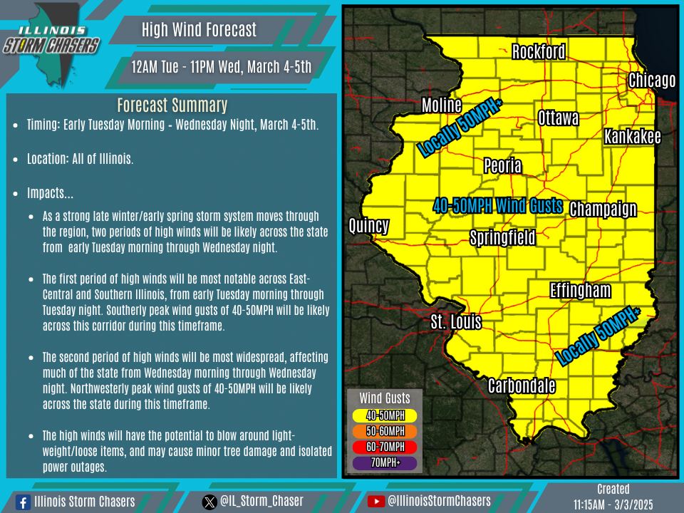
Timing…
•Early Tuesday Morning – Wednesday Night, March 4-5th.
Location…
•All of Illinois.
Impacts…
•The first period of high winds will be most notable across East-Central and Southern Illinois, from early Tuesday morning through Tuesday night. Southerly peak wind gusts of 40-50MPH will be likely across this corridor during this timeframe.
•The second period of high winds will be most widespread, affecting much of the state from Wednesday morning through Wednesday night. Northwesterly peak wind gusts of 40-50MPH will be likely across the state during this timeframe.
•The high winds will have the potential to blow around light-weight/loose items, and may cause minor tree damage and isolated power outages.
Discussion…
•As a strong late winter/early spring storm system moves through the region over the next few days, two rounds of high winds will impact the state. The first round of high winds will be a product of a strong southerly low-level jet on the front-side of the storm system and adequate atmospheric mixing. This first round will be most noteworthy across East-Central and Southern Illinois, with southerly 40-50MPH peak wind gusts will be likely from tonight through Tuesday night. The second round of high winds will be a product of a strong northwesterly low-level jet on the back-side of the storm system and adequate atmospheric mixing. The second round of high winds will be more widespread, affecting all of the state with northwesterly 40-50MPH peak wind gusts from Wednesday morning through Wednesday night.
