
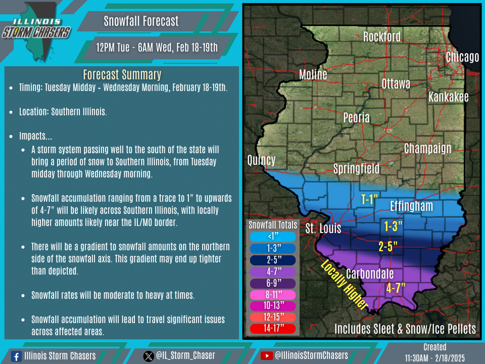
(11:30AM – Tuesday, February 18th, 2025) Tuesday morning update on a storm system passing well to the south of the state that will bring a period of snow to Southern Illinois, from Tuesday midday through Wednesday morning. Several inches of accumulating snow will be likely across affected areas.
Timing…
•Tuesday Midday – Wednesday Morning, February 18-19th.
Location…
•Southern Illinois.
Impacts…
•Snowfall accumulation ranging from a trace to 1″ to upwards of 4-7″ will be likely across Southern Illinois, with locally higher amounts likely near the IL/MO border.
•There will be a gradient to snowfall amounts on the northern side of the snowfall axis. This gradient may end up tighter than depicted.
•Moderate to heavy snowfall rates will be likely at times between later this afternoon through very early Wednesday morning.
•Significant travel impacts are likely across affected areas.
Update…
•With this update, little to no changes were needed, as the going forecast is on track.
Discussion…
•A storm system passing well to the south of the state will bring a period of snow to Southern Illinois, from Tuesday midday through Wednesday morning. With cold air established in the region and across the state, this will be an all snow affair for affected areas. Forecast soundings show temperatures deep within the column either within or on the border of the DGZ, signaling the potential for above average snowfall ratios. Banding to the snowfall will be possible, especially across Southern Illinois. Snow will be moderate to heavy at times as well.
