(11:30PM – Tuesday, February 11th, 2025) Tuesday night update on a winter storm set to impact the state from tonight through Thursday morning, bringing impactful winter weather to the state, headlined by several inches of snow expected across a large portion of the state.
Timing…
•Tonight – Early Thursday morning, February 11-13th.
Location…
•Much of Illinois.
Impacts…
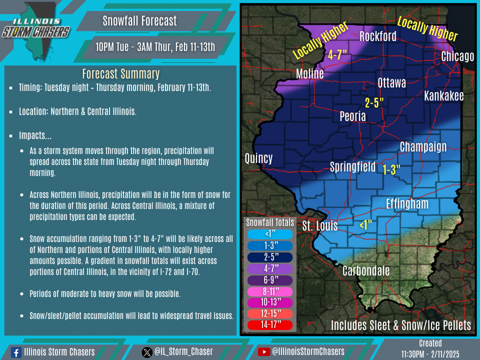
•Snow accumulation ranging from 1-3″ to 4-7″ will be likely across all of Northern and portions of Central Illinois, with locally higher amounts possible. A gradient in snowfall totals will exist across portions of Central Illinois, in the vicinity of I-72 and I-70.
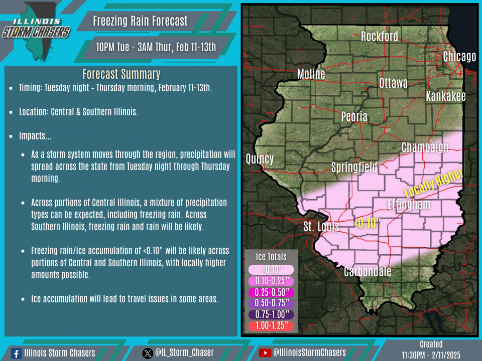
•Freezing rain/ice accumulation of <0.10″ will be likely across portions of Central and Southern Illinois, with locally higher amounts possible.
•While high winds are not expected, wind gusts of 15-30MPH will still lead to some blowing and drifting of snow, especially in open/rural areas.
•Moderate to heavy snowfall rates will be possible at times across portions of Northern and Central Illinois, especially from Wednesday mid/late morning through Wednesday evening.
Update…
With this forecast update, little in the way of changes were needed, as the going forecast is generally on track.
Discussion…
•As a storm system moves through the region, precipitation will spread across the state from tonight through early Thursday morning.
•Across Northern and portions of Central Illinois, snow will be favored for the duration of this winter storm. Broad snowfall accumulation of a couple to several inches can be expected across these areas. Additionally, a gradient in snowfall totals will exist across portions of Central Illinois, in the vicinity of I-72 and I-70. Sleet/pellets will be possible along this gradient area as well.
•Across other portions of Central and Southern Illinois, a corridor of freezing rain can be expected, with precipitation expected to be in the form of rain across far Southern Illinois.