
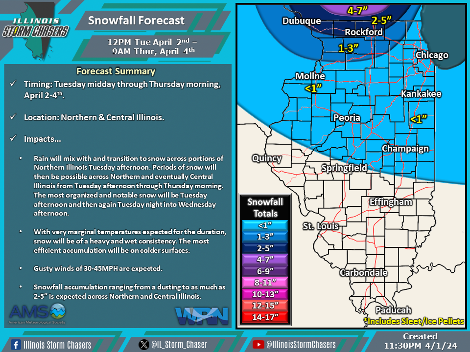
(11:30PM – Monday, April 1st, 2024) Monday night update on the storm system moving through the region that will bring the opportunity for accumulating snow to portions of the state from Tuesday afternoon through Thursday morning.
Update…
•With this update, little changes were needed to the going forecast.
Timing…
•Tuesday Midday – Thursday Morning, April 2-4th.
Location…
•Northern & Central Illinois.
Impacts…
•Rain will mix with and transition to snow across portions of Northern Illinois Tuesday afternoon. Periods of snow will then be possible across Northern and eventually Central Illinois from Tuesday afternoon through Thursday morning. The most organized and notable snow will be Tuesday afternoon and then again Tuesday night into Wednesday afternoon.
•With very marginal temperatures expected for the duration, snow will be of a heavy and wet consistency. The most efficient accumulation will be on colder surfaces.
•Gusty winds of 30-40MPH are expected.
•Snowfall accumulation ranging from a dusting to as much as 2-5” is expected across Northern and Central Illinois.
