
(7:00PM – Wednesday, September 25th, 2024) The remnants of Hurricane Helene are expected to spiral through the region from late this week through late this weekend. Interaction with an upper level low in the region is also expected, with both pieces expected to jointly bring periods of rain and a period of high winds to portions of the state.
Timing…
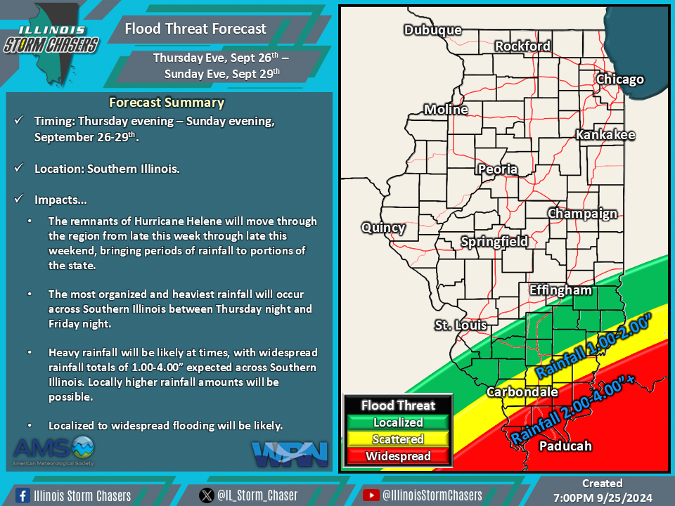
•Thursday Evening – Sunday Evening, September 26-29th.
Location…
•Much of Illinois.
Impacts…
•Periods of rain will be likely across the state from Thursday evening through Sunday evening.
•Of note will be a likely period of organized and heavy rainfall across Southern Illinois between Thursday night and Friday night. •Event rainfall totals across Southern Illinois will range from 1.00-4.00″, with locally higher totals possible. Localized to widespread flooding will be possible.
•A period of gusty/high winds is likely across a large portion of the state from Thursday night through Friday night. During this time, wind gusts of 35-55MPH will be likely across a large portion of the state.
Discussion…
•As the remnants of Hurricane Helene spiral through the region, interaction will occur with an upper level low sitting in the region. As this interaction between both pieces happens, a fujiwhara effect will occur, as well as phasing. These two pieces will jointly lead to periods of rainfall across the state over a multi-day period, including a period of heavy rainfall/flooding potential maximized across Southern Illinois from Thursday night through Friday night. In additional to the rainfall aspect, a period of gusty/high winds can be expected across a large portion of the state from Thursday night through Friday night.

