
(11:30PM – Friday, July 25th, 2025) Severe t’storm continues into part of the weekend…
Timing & Location…
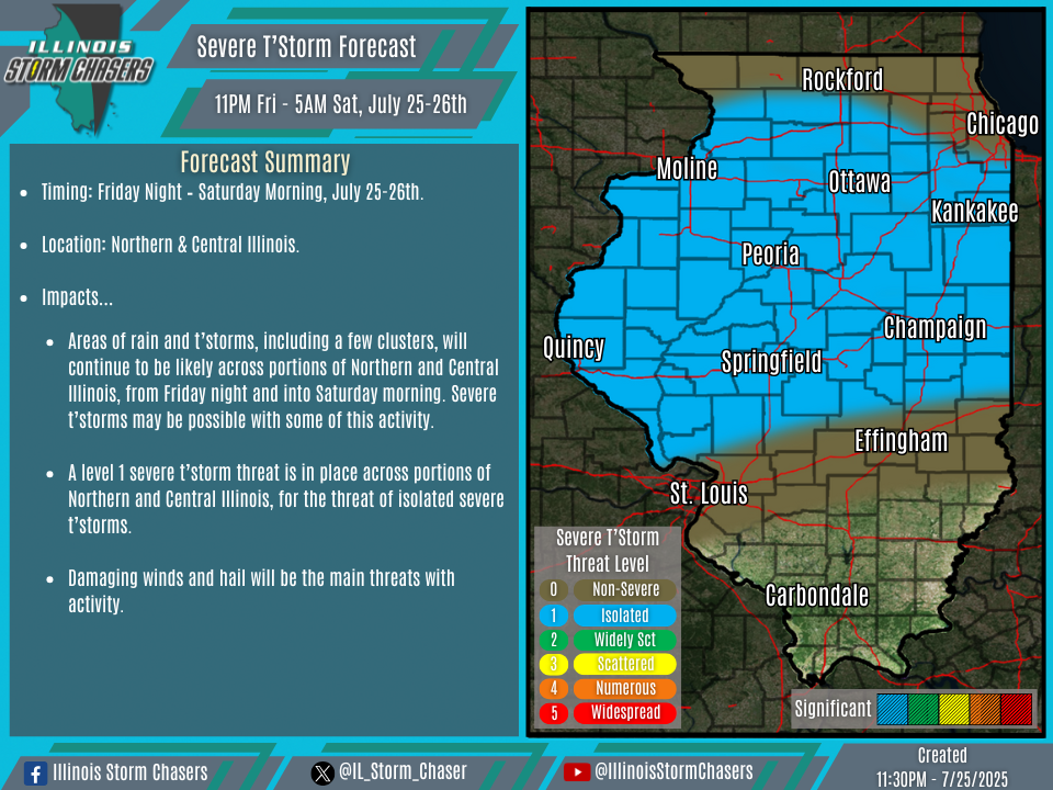
•Friday Night – Saturday Morning, July 25-26th: Large Portion Of Illinois.
•Saturday Morning – Sunday Morning, July 26-27th: Northern & Central Illinois.
Impacts…
•A level 1 severe t’storm threat is in place across portions of Northern and Central Illinois from Friday night into Saturday morning, for the threat of isolated severe t’storms. Damaging winds and hail will be the main threats with activity.
•A level 1 severe t’storm threat is in place across much of Northern and Central Illinois on Saturday/Saturday night, for the threat of isolated severe t’storms. Damaging winds and hail will be the main threats with activity.
Discussion…
•Friday Night… Areas of rain and t’storms, including a few clusters, will continue to be likely across portions of Northern and Central Illinois, from Friday night and into Saturday morning. Severe t’storms may be possible with some of this activity.
•Saturday/Saturday Night… Areas of rain and t’storms will be ongoing across portions of Northern and Central Illinois on Saturday morning, with some of this activity likely to persist into the afternoon, perhaps re-strengthening. In the wake of this earlier activity, the development of a new round of rain and t’storms will be likely on Saturday afternoon, with the activity expected to track across portions of Northern and Central Illinois, from Saturday afternoon through Saturday night. Severe t’storms may be possible with some of this activity.

