
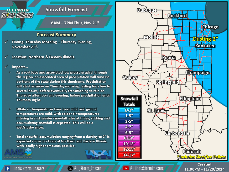
(11:00PM – Wednesday, November 20th, 2024) Wednesday night update on a disturbance that will move through the region, with an associated area of precipitation that will traverse portions of the state. Some of this precipitation will fall as snow, with the first notable minor accumulation of the season expected across portions of Northern and Eastern Illinois. Additionally, a period of high winds will accompany the expected precipitation.
Timing…
•Thursday Morning – Thursday Night, November 21st.
Location…
•Much of Illinois.
Impacts…
•Total snowfall accumulation ranging from a dusting to 2” is expected across portions of Northern and Eastern Illinois, with locally higher amounts possible.
•Wind gusts of 35-50MPH are likely across much of the state.
Discussion…
•As a vort lobe and associated low pressure spiral through the region, an associated area of precipitation and high winds will be expected portions of the state during this timeframe. Precipitation will start as snow on Thursday morning, lasting for a few to several hours, before eventually transitioning to rain on Thursday afternoon and evening, before precipitation ends Thursday night. High winds will ramp up with the onset of precipitation on Thursday morning and will diminish Thursday night as precipitation ends.
•While air temperatures have been mild and ground temperatures are mild, with colder air temperatures filtering in and heavier snowfall rates at times, sticking and accumulating snowfall are likely.
•The snowfall will be wet/slushy.
•The high winds will have the potential to blow around loose/light weight items and cause minor tree damage. Power outages will be possible.

