
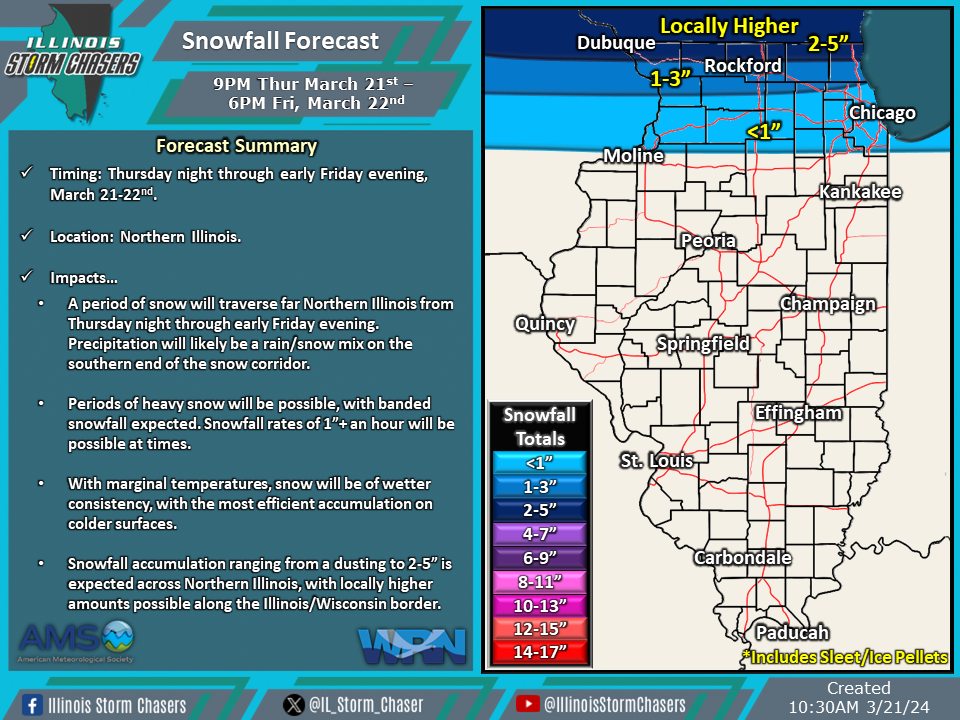
(11:15AM – Thursday, March 21st, 2024) Thursday morning update on a storm system moving through the region that will bring a period of accumulating snowfall to Northern Illinois from tonight through early Friday evening.
Update…
•With this update, we have slightly adjusted the snowfall accumulation corridor a bit north, based on latest weather guidance trends.
Timing…
•Tonight – Early Friday Evening, March 21-22nd.
Location…
•Northern Illinois.
Impacts…
•A period of snow will traverse Northern Illinois from tonight through early Friday evening. Precipitation will likely be a rain/snow mix on the southern end of the snow corridor.
•Periods of heavy snow will be possible, with banded snowfall expected. Snowfall rates of 1”+ an hour will be possible at times.
•With marginal temperatures, snow will be of wetter consistency, with the most efficient accumulation on colder surfaces.
•Snowfall accumulation ranging from a dusting to 2-5” is expected across Northern Illinois, with locally higher amounts possible along the Illinois/Wisconsin border.
