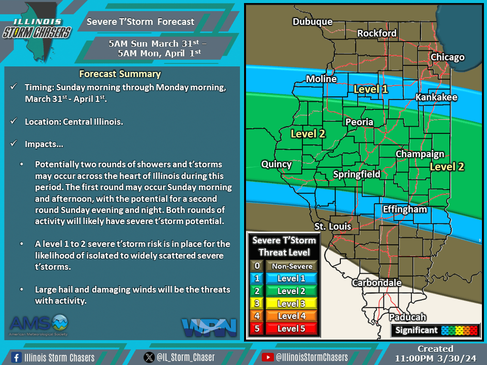
(11:00PM – Saturday, March 30th, 2024) Saturday night update on multiple disturbances and a main storm system will move through the region, bringing several rounds of rain and t’storms, with the potential for severe t’storms, to portions of the state from Sunday into Tuesday.
Update…
•With this update, little to no changes were needed with the going severe t’storm forecast for Sunday/Sunday night.
•With this update, we have issued our initial severe t’storm forecast for Monday/Monday night.
Timing & Location…
•Sunday Morning – Monday Morning, March 31st-April 1st: Central Illinois.
•Monday Morning – Tuesday Morning, April 1-2nd: Central & Southern Illinois
Impacts…
•A level 1 to 2 severe t’storm risk is in place across Central Illinois from Sunday morning through Monday morning. Isolated to widely scattered severe t’storms will be likely, posing a risk of large hail and damaging winds. Potentially two rounds of showers and t’storms may occur across the heart of Illinois during this period. The first round may occur Sunday morning and afternoon, with the potential for a second round Sunday evening and night. Both rounds of activity will likely have severe t’storm potential.
•A level 1 to 2 severe t’storm risk is in place across Central and Southern Illinois from Monday morning through Tuesday morning. Isolated to widely scattered severe t’storms will be likely, posing a risk of large hail, damaging winds, and an isolated tornado. Periods of rain and t’storms are expected from Monday morning through Tuesday morning. Severe t’storms will be possible this activity throughout this period.