
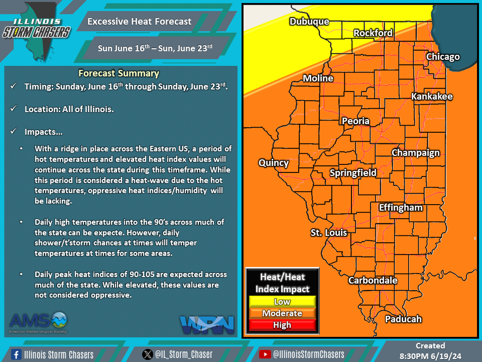
(8:30PM – Wednesday, June 19th, 2024) Wednesday update on the heat wave that will continue to affect the state through this upcoming weekend (June 23rd). This heat wave is a product of a ridge entrenched across the Eastern US, which is bringing the period of hot temperatures across the state.
Timing & Location…
•Sunday, June 16th – Sunday, June 23rd: All of Illinois.
Impacts…
•Daily high temperatures in the 90’s can be expected across much of the state.
•Daily heat index values in to 90’s to around 100 can be expected across much of the state.
•Daily shower/t’storm chances across portions of the state will temper conditions in some areas at times.
Discussion…
•A ridge that is entrenched across the Eastern US will continue to bring a multi-day period of hot temperatures to the state through this upcoming weekend (June 23rd). Daily chances of showers/t’storms across the state may temper conditions for some areas at times. While heat index values will be elevated on a daily basis during this period, oppressive conditions are not expected. Thus, while this period is a heat wave, it will be temperature-based and not heat index/humidity-based.
Short Term/Three-Day Forecast…
•Thur, June 20th: High temperatures of 88-96 across much of the state, with peak heat indices of 89-103. (Cooler far Northern Illinois)
•Fri, June 21st: High temperatures of 89-97 across much of the state, with peak heat indices of 89-103. (Cooler far Northern Illinois)
•Sat, June 22nd: High temperatures of 90-99 across the entire state, with peak heat indices of 91-103.
•Forecasts for later dates will be provided in future updates.
