
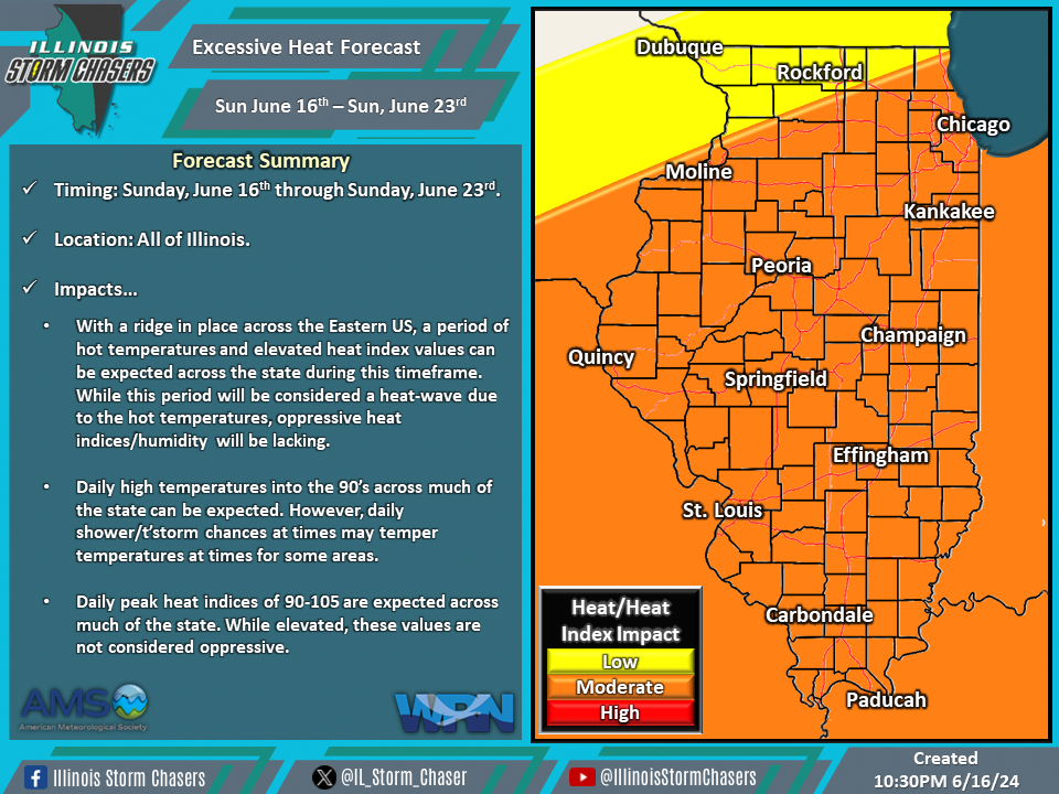
(10:30PM – Sunday, June 16th, 2024) Sunday update on the heat wave that will continue to affect the state into this upcoming week and potentially into next weekend (June 22/23rd) as well. This heat wave is a product of a ridge entrenched across the Eastern US, which is bringing the period of hot temperatures across the state.
Timing & Location…
•Sunday, June 16th – Sunday, June 23rd: All of Illinois.
Impacts…
•Daily high temperatures in the 90’s can be expected across much of the state.
•Daily heat index values between 90-105 can be expected across much of the state.
•Daily shower/t’storm chances across portions of the state will temper conditions in some areas at times.
Discussion…
•A ridge that is entrenched across the Eastern US will continue to bring a multi-day period of hot temperatures to the state through this upcoming week and potentially into next weekend (June 22/23rd). Daily chances of showers/t’storms across the state may temper conditions for some areas at times. While heat index values will be elevated on a daily basis during this period, oppressive conditions are not expected. Thus, while this period will be considered a heat wave, it will be temperature-based and not heat index/humidity-based.
Short Term/Three-Day Forecast…
•Mon, June 17th: High temperatures of 88-99 across the state, with peak heat indices of 90-103.
•Tues, June 18th: High temperatures of 88-98 across the state, with peak heat indices of 90-103.
•Wed, June 19th: High temperatures of 88-99 across the state, with peak heat indices of 90-103.
•Forecasts for later dates will be provided in future updates.
