
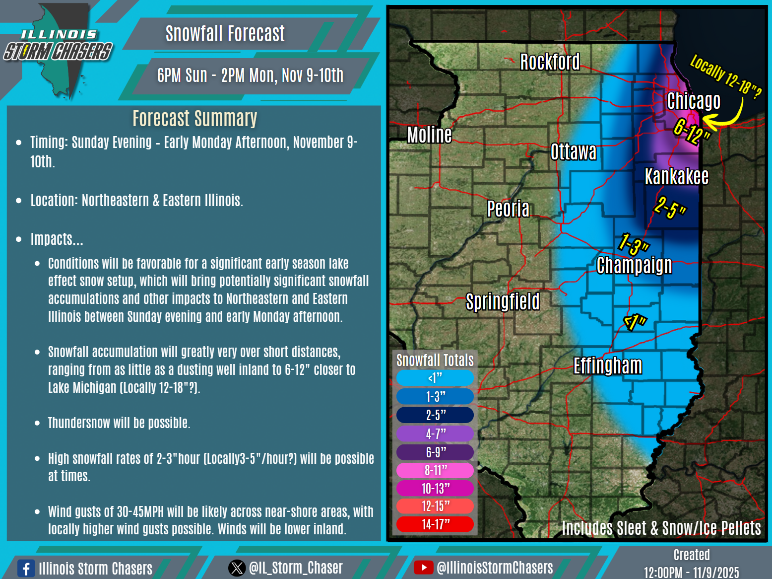
(12:00PM – Sunday, November 9th, 2025) A potentially significant early season lake effect snow event will impact a large portion of Northeastern and Eastern Illinois between Sunday evening and early Monday afternoon.
⏰Timing…
•Early Sunday Evening – Early Monday Afternoon, November 9-10th.
📍Location…
•Northeastern & Eastern Illinois.
❄️Hazards…
•Snowfall accumulation will greatly very over short distances, ranging from as little as a dusting well inland to 6-12″ closer to Lake Michigan (Locally 12-18″?).
•Thundersnow will be possible.
•High snowfall rates of 2-3″hour (Locally 3-5″/hour?) will be possible at times.
•Wind gusts of 30-45MPH will be likely in near-shore areas, locally up to 50MPH. Winds will be lower inland.
✔️Summary…
•High end parameters will be in place and favorable for a potentially significant early season lake effect snow setup, which will bring accumulating snow and other impacts to Northeastern and Eastern Illinois between Sunday evening and early Monday afternoon.
