
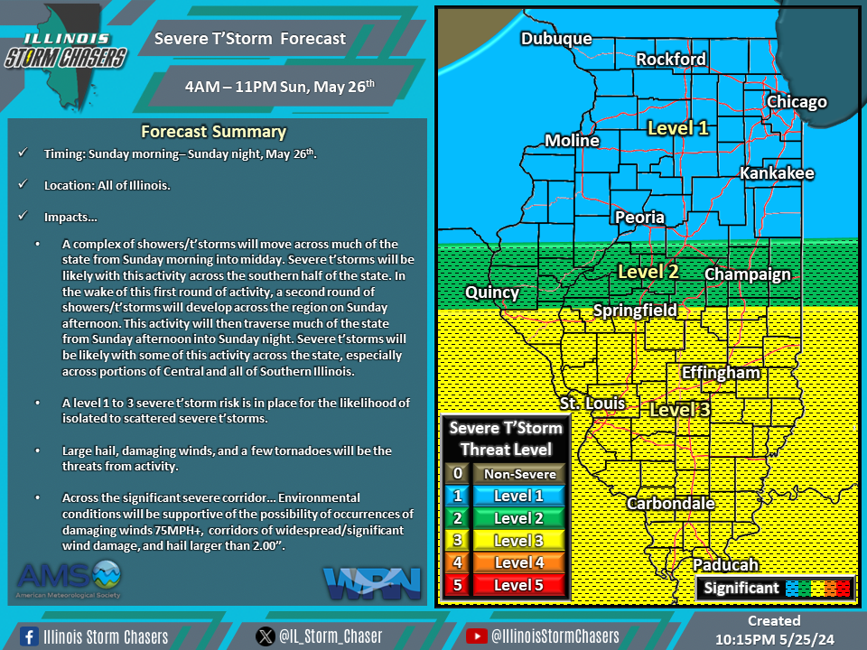
(10:15PM – Saturday, May 25th, 2024) Saturday night update on a storm system will move through the region on Sunday, bringing a few rounds of rain and t’storms to the state from Sunday morning through Sunday night, with the likelihood of severe t’storms with some of the activity.
Update…
•With this update, little changes were needed on the severe t’storm forecast for Sunday/Sunday night.
Timing…
•Sunday Morning – Sunday Night, May 26th.
Location…
•All of Illinois.
Impacts…
•A level 1 to 3 severe t’storm risk is in place across all of Illinois from Sunday morning through Sunday night for the likelihood of isolated to scattered severe t’storms. Large hail, damaging winds, and a few tornadoes will be the threats from activity. Across the significant severe corridor… Environmental conditions will be supportive of the possibility of occurrences of damaging winds 75MPH+, corridors of widespread/significant wind damage, and hail larger than 2.00”. A complex of showers/t’storms will move across much of the state from Sunday morning into midday. Severe t’storms will be likely with this activity across the southern half of the state. In the wake of this first round of activity, a second round of showers/t’storms will develop across the region on Sunday afternoon. This activity will then traverse much of the state from Sunday afternoon into Sunday night. Severe t’storms will be likely with some of this activity across the state, especially across portions of Central and all of Southern Illinois.
