
(11:00PM – Friday, July 17th, 2026)
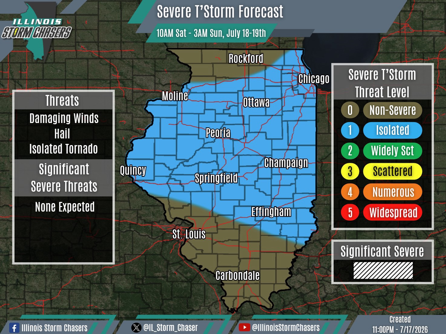
A severe weather threat is expected across a chunk of the state on Saturday/Saturday night.
As a storm system moves through the Great Lakes, a trailing cold front will sweep across the state on Saturday/Saturday night. A broken line of t’storms will develop along this advancing cold front between Saturday midday and mid-afternoon across portions of Northern and Central Illinois. This broken line of activity will then track southeastward, affecting Central and perhaps portions of Southern Illinois into Saturday evening and Saturday night.
An Isolated (level 1) severe weather threat will be possible with this activity across a large chunk of the state. Damaging winds and small hail will be the main threats.
#ilwx #severeweather
