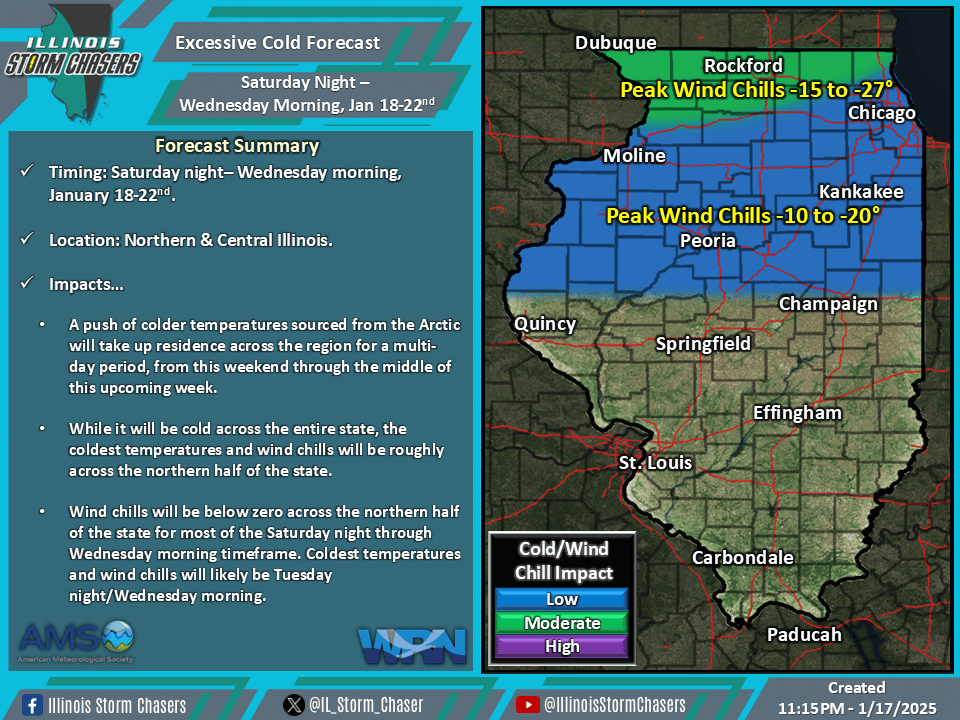
(11:15PM – Friday, January 17th, 2025) As a large trough digs in across the eastern half of Canada and the U.S., a branch of the polar jet stream will accompany it, bringing down a significant chunk of deep Artic air into the region. This will lead to a multi-day period of cold temperatures and wind chills across the state from late Saturday through early Wednesday.
Timing…
•Saturday Night – Wednesday Morning, January 18-22nd.
Location…
•Northern & Central Illinois.
Impacts…
•Cold temperatures and wind chills will be likely across the state on a daily/nightly basis during this timeframe, with nightly conditions being the most impactful.
•The most impactful conditions will be across the northern half of the state, which includes all of Northern and portions of Central Illinois.
•Wind chills will generally be below zero for the entire timeframe of Saturday night through Wednesday morning across the northern half of the state, which includes all of Northern and portions of Central Illinois.
•Near zero to below zero overnight/early morning low temperatures can be expected on a nightly basis across portions of Northern Illinois.
•Wind chills of -5 to -20 will be common across all of Northern and portions of Central Illinois much of this timeframe.
•The coldest conditions will be Tuesday night, when peak wind chills of -10 to -27 will be likely across all of Northern and portions of Central Illinois.