
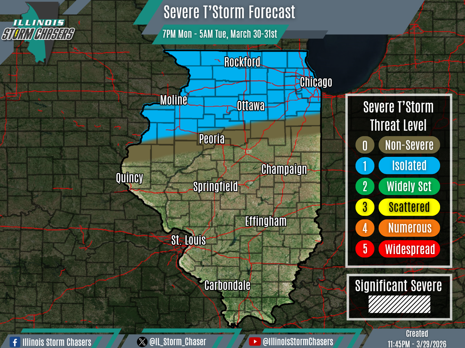
(11:45PM – Sunday, March 29th, 2026) Early week severe t’storm threat…
⏰📍Timing & Location…
•Early Monday Night – Early Tuesday Morning, March 30-31st: Northern Illinois.
•Tuesday afternoon – Tuesday Night, March 31st: Northern & Central Illinois.
⚡️Hazards…
•A level 1 severe t’storm threat is in place across Northern Illinois from this early Monday night through early Friday morning, for the threat of isolated severe t’storms. Large hail and damaging winds will be the threats with activity.
•A level 1 severe t’storm threat is in place across much of Northern and Central Illinois from Tuesday afternoon through Tuesday nightn, for the threat of isolated severe t’storms. Large hail and damaging winds will be the main threats.
✔️Summary…
•As a lead disturbance moves through the region, isolates to scattered showers and t’storms will develop across Iowa on Monday evening. This activity will then track across Northern Illinois Monday night and into early Tuesday morning. Some severe t’storm threat will be possible with this activity.
•As a main storm system passes through the region, scattered showers and t’storms will develop Tuesday afternoon across portions of Northern Illinois, along and in the vicinity of an advancing cold front. This activity, along with further development to the southwest, will then track across much of Northern and Central Illinois from Tuesday afternoon through Tuesday night. Some severe t’storm threat will be likely with this activity.

