
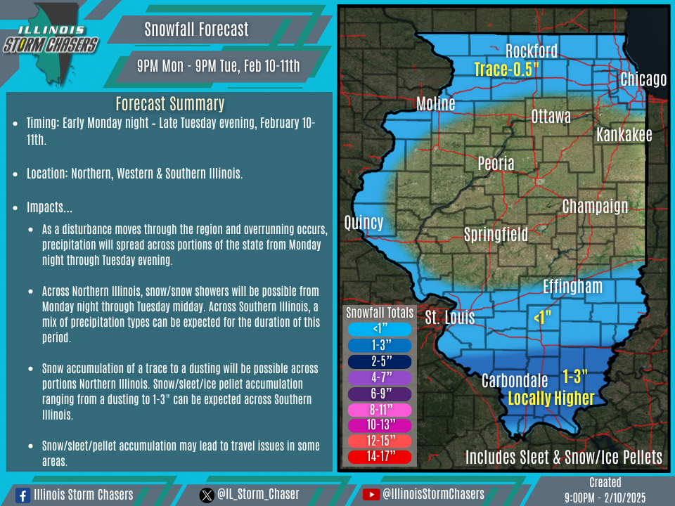
(9:00PM – Monday, February 10th, 2025) Monday night update on a disturbance moving through the region, combined with overrunning, which will bring associated precipitation to portions of the state from tonight through Tuesday evening. Mixed precipitation types will be likely across portions of the state during this period, with wintry precipitation accumulations expected across portions of the state.
Timing…
•Tonight – Late Tuesday evening, February 10-11th.
Location…
•Northern, Western & Southern Illinois.
Impacts…
•Snow accumulation of a trace to a dusting will be possible across portions Northern Illinois. Snow/sleet/ice pellet accumulation ranging from a dusting to 1-3″ can be expected across Southern Illinois.
•Freezing rain/ice accumulation of a glaze will be likely across Southern Illinois.
•Snow/sleet/pellet/ice accumulation will lead to travel issues in some areas.
Update…
•With this update, little changes were needed, as the going forecast is on track.
Discussion…
•As a disturbance moves through the region and overrunning occurs, precipitation will spread across the state from tonight through Tuesday evening.
•Across Northern and Western Illinois, snow/snow showers will be possible from early tonight through Tuesday midday. While things will already be ont he minor side, weakening forcing and dry air in place may limit this potential overall.
•Across Southern Illinois, a mix of precipitation types can be expected for the duration of this period. The main focus of this period will be Southern Illinois, where better forcing will occur, with an overlap from overrunning. This will lead to higher precipitation rates across this area, and expected wintry precipitation accumulations.

