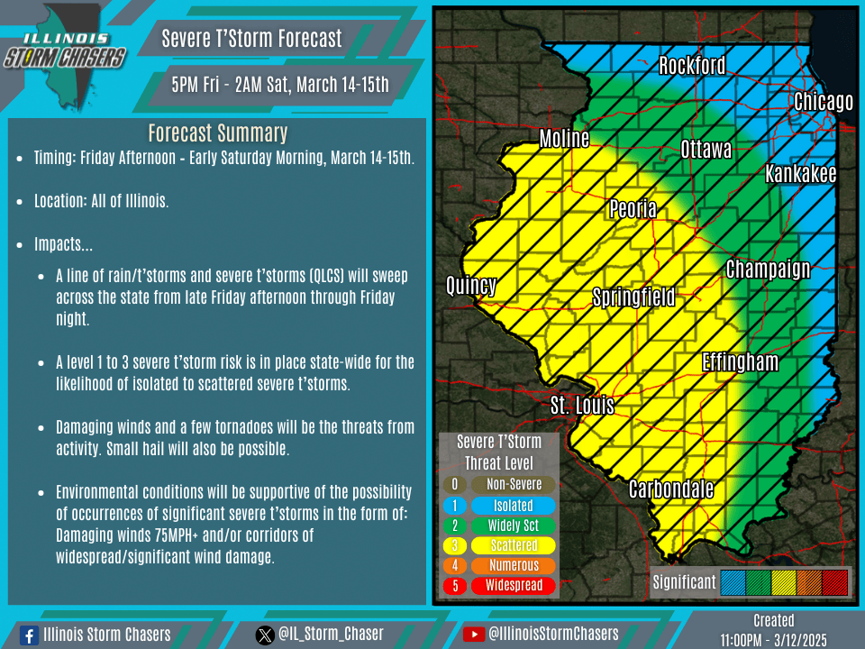
(11:00PM – Wednesday, March 12th, 2025) As a strong storm system moves through the region, a line of rain/t’storms and severe t’storms (QLCS) will sweep across the state from late Friday afternoon through Friday night.
Timing…
•Late Friday Afternoon – Early Saturday Morning, March 14-15th.
Location…
•All of Illinois.
Impacts…
•A level 1 to 3 severe t’storm risk is in place state-wide for the likelihood of isolated to scattered severe t’storms.
•Damaging winds and a few tornadoes will be the threats from activity. Small hail will also be possible.
•Environmental conditions will be supportive of the possibility of occurrences of significant severe t’storms in the form of: Damaging winds 75MPH+ and/or corridors of widespread/significant wind damage.
Discussion…
•As a strong storm system moves through the region, a line of rain/t’storms and severe t’storms (QLCS) will develop on Friday afternoon across portions of Iowa and Missouri. This QLCS will rapidly traverse the state between late Friday afternoon and early Saturday morning. The setup with this storm system is one of a classic early spring variety, featuring ample shear/forcing and limited instability/moisture. Even with the aforementioned, severe t’storm activity can be expected across the state. Damaging winds and a few tornadoes will be the most favored threats. Even as activity tends to weaken with time and lightning production may decrease with time, a strong low-level jet just off of the surface and ample mixing will allow damaging wind gusts to reach the surface even with weaker activity. This will also allow for the potential of a few significant severe t’storms capable of producing damaging winds of 75MPH+ and/or corridors of wind damage. A few QLCS tornadoes will be possible, with weather guidance soundings showing ample low level shear and nicely curved hodographs.