
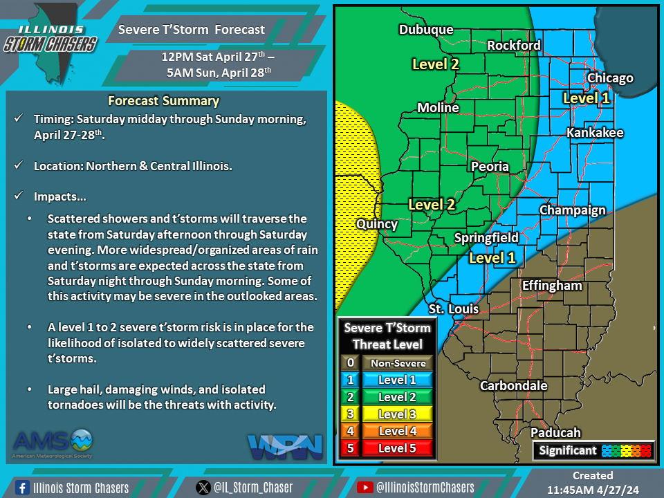
(11:45AM – Saturday, April 27th, 2024) Saturday morning update on two storm systems that will continue to move through the region, bringing several rounds of rain and t’storms, with the potential for severe t’storms, to portions of the state through Monday.
Update…
•With this update, on the severe t’storm forecast for today/tonight, little in the way of change were needed. The going forecast is on track based on the latest guidance and real-time data.
•With this update, on the severe t’storm forecast for Sunday/Sunday night, we have further expanded level 1 severe t’storm probabilities to include the small remaining portion that wasn’t previously included. We have also increased severe t’storm probabilities to a level 2 threat across Southwestern Illinois.
Timing & Location…
•This Afternoon – Sunday Morning, April 27-28th: Northern & Central Illinois.
•Sunday Morning – Monday Morning, April 28-29th: All of Illinois.
•Monday Morning – Monday Evening, April 29th: TBD.
Impacts…
•A level 1 to 2 severe t’storm risk is in place across Northern and Central Illinois from this afternoon through Sunday morning for the possibility of isolated to widely scattered severe t’storms. Large hail, damaging winds, and isolated tornadoes will be the threats with activity. Scattered showers and t’storms will traverse the state from Saturday afternoon through Saturday evening. More widespread/organized areas of rain and t’storms are expected across the state from Saturday night through Sunday morning. Some of this activity may be severe in the outlooked areas.
•A level 1 to 2 severe t’storm risk is in place across all of Illinois from Sunday morning through Monday morning for the possibility of isolated to widely scattered severe t’storms. Large hail, damaging winds, and an isolated tornado will be the threats with activity. Scattered showers and t’storms will traverse the state from Sunday morning through Monday morning. Some of this activity may be severe in the outlooked areas.
•A severe t’storm threat will also exist on Monday. More specific information regarding the potential for this day is to come in future updates.

